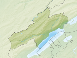
La Tène, NE
| La Tène | ||
|---|---|---|
|
||
| Coordinates: 47°01′N 7°01′E / 47.017°N 7.017°ECoordinates: 47°01′N 7°01′E / 47.017°N 7.017°E | ||
| Country | Switzerland | |
| Canton | Neuchâtel | |
| District | Neuchâtel | |
| Area | ||
| • Total | 5.44 km2 (2.10 sq mi) | |
| Elevation | 450 m (1,480 ft) | |
| Population (Dec 2016) | ||
| • Total | 4,967 | |
| • Density | 910/km2 (2,400/sq mi) | |
| Postal code | 2074 | |
| SFOS number | 6461 | |
| Surrounded by | Cudrefin (VD), Gampelen (BE), Ins (BE), Saint-Blaise, Thielle-Wavre | |
| Website |
www SFSO statistics |
|
La Tène (French pronunciation: [la tɛn]) is a municipality in the district of Neuchâtel in the Swiss canton of Neuchâtel. On 1 January 2009, the former municipalities of Marin-Epagnier and Thielle-Wavre merged to form the new municipality of La Tène.
The La Tène municipality is named for La Tène, a village formerly in the Marin-Epagnier municipality, notable as the eponymous site of the Iron Age archaeological La Tène culture.
La Tène has an area, as of 2009[update], of 5.4 square kilometers (2.1 sq mi). Of this area, 2.65 km2 (1.02 sq mi) or 48.7% is used for agricultural purposes, while 0.45 km2 (0.17 sq mi) or 8.3% is forested. Of the rest of the land, 2 km2 (1 sq mi) or 36.8% is settled (buildings or roads), 0.21 km2 (0.08 sq mi) or 3.9% is either rivers or lakes and 0.13 km2 (32.12 acres) or 2.4% is unproductive land.
Of the built up area, industrial buildings made up 6.1% of the total area while housing and buildings made up 14.2% and transportation infrastructure made up 11.9%. while parks, green belts and sports fields made up 3.9%. Out of the forested land, all of the forested land area is covered with heavy forests. Of the agricultural land, 41.9% is used for growing crops and 3.3% is pastures, while 3.5% is used for orchards or vine crops. Of the water in the municipality, 0.2% is in lakes and 3.7% is in rivers and streams.
It is located at the northeastern tip of Lake Neuchâtel at an elevation of 455 meters, and, as of December 2016, a population of 4,967 people. It lies close to Biel/Bienne, at the boundary between French- and German-speaking regions, and at a knot of highways.
...
Wikipedia


