La Plata
| La Plata | |||
|---|---|---|---|
| Ciudad de La Plata | |||

From top left: Estación del Ferrocarril Roca • High view of Plaza Dardo Rocha • Garibaldi's statue • Legislatura Provincia de Buenos Aires • Palacio Municipal • Catedral • Museo de Ciencias Naturales • Estadio Ciudad de La Plata.
|
|||
|
|||
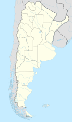
| Location in Argentina | |||
| Coordinates: 34°55′16″S 57°57′16″W / 34.92111°S 57.95444°WCoordinates: 34°55′16″S 57°57′16″W / 34.92111°S 57.95444°W | |||
| Country |
|
||
| Province |
|
||
| Partido | La Plata | ||
| Founded | 1882 | ||
| Founded by | Dardo Rocha | ||
| Government | |||
| • Intendant | Julio Garro | ||
| Area | |||
| • City | 203 km2 (78.5 sq mi) | ||
| • Land | 203 km2 (78.5 sq mi) | ||
| • Metro | 4,758 km2 (1,837 sq mi) | ||
| Elevation | 26 m (85 ft) | ||
| Population (2001)2001 census [INDEC] | |||
| • City | 765,378 | ||
| • Density | 3,800/km2 (9,800/sq mi) | ||
| • Metro | 899,523 | ||
| Demonym(s) | platense | ||
| Time zone | ART (UTC−3) | ||
| CPA Base | 1900 | ||
| Area code(s) | +54 221 | ||
| Website | http://www.laplata.gov.ar | ||
La Plata is the capital city of the Province of Buenos Aires, Argentina, and of the partido La Plata. According to the 2001 census [INDEC], it has a population of 765,378 and its metropolitan area has 899,523 inhabitants.
La Plata was planned and developed to serve as the provincial capital after the city of Buenos Aires was federalized in 1880. It was officially founded by Governor Dardo Rocha on 19 November 1882. Its construction is fully documented in photographs by Tomás Bradley Sutton. La Plata was renamed Eva Perón City (Ciudad Eva Perón) between 1952 and 1955.
The city is home to two important first division football teams: Estudiantes de La Plata and Gimnasia y Esgrima La Plata.
Rocha decided to erect a new city to host the provincial government institutions and a university which had already been planned. Urban planner Pedro Benoit designed a city layout based on a rationalist conception of urban centers. The city has the shape of a square with a central park and two main diagonal avenues, north to south and east to west. In addition, there are numerous other shorter diagonal streets. This design is copied in a self-similar manner in small blocks of six by six blocks in length. For every six blocks, there is a small park or square. Other than the diagonal streets, all streets are on a rectangular grid and are numbered consecutively. Thus, La Plata is nicknamed "la ciudad de las diagonales" (city of diagonals). It is also called "la ciudad de los tilos" (city of linden trees), because of the large number of linden trees lining the many streets and squares. The linden tree is one of a number of deciduous Northern Hemisphere tree species which dominate La Plata's parks and streets; ash, horsechestnut, plane, sweetgum and tulip tree are among the other examples. Palms and subtropical broadleaf evergreen trees thrive, but are comparatively infrequent.
...
Wikipedia


