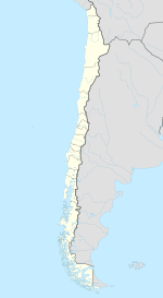
La Pintana
| La Pintana | ||||||
|---|---|---|---|---|---|---|
| City and Commune | ||||||
|
||||||
| Coordinates: 33°35′S 70°38′W / 33.583°S 70.633°WCoordinates: 33°35′S 70°38′W / 33.583°S 70.633°W | ||||||
| Country | Chile | |||||
| Government | ||||||
| • Type | Municipality | |||||
| • Alcalde | Jaime Pavez Moreno (PPD) | |||||
| Area | ||||||
| • Total | 30.6 km2 (11.8 sq mi) | |||||
| Population (2002 Census) | ||||||
| • Total | 190,085 | |||||
| • Density | 6,200/km2 (16,000/sq mi) | |||||
| • Urban | 190,085 | |||||
| • Rural | 0 | |||||
| Sex | ||||||
| • Men | 94,963 | |||||
| • Women | 95,122 | |||||
| Time zone | CLT (UTC-4) | |||||
| • Summer (DST) | CLST (UTC-3) | |||||
| Area code(s) | 56 + | |||||
| Website | Municipality of La Pintana | |||||
La Pintana is a commune of Chile located in Santiago Province, Santiago Metropolitan Region. La Pintana is home to Antumapu, the agricultural and veterinary sciences campus of University of Chile, Chile's oldest university.
According to the 2002 census of the National Statistics Institute, La Pintana spans an area of 30.6 km2 (12 sq mi) and has 190,085 inhabitants (94,963 men and 95,122 women), making the commune an entirely urban area. The population grew by 12.1% (20,445 persons) between the 1992 and 2002 censuses. The 2006 projected population was 201,183.
As a commune, La Pintana is a third-level administrative division of Chile administered by a municipal council, headed by an alcalde who is directly elected every four years. The 2012-2016 alcalde is Jaime Pavez Moreno (PPD). The communal council has the following members:
Within the electoral divisions of Chile, La Pintana is represented in the Chamber of Deputies by Osvaldo Andrade (PS) and Leopoldo Pérez (RN) as part of the 29th electoral district, (together with Puente Alto, Pirque and San José de Maipo). The commune is represented in the Senate by Soledad Alvear (PDC) and Pablo Longueira (UDI) as part of the 8th senatorial constituency (Santiago-East).
...
Wikipedia


