La Corbière

Corbiere Lighthouse, Jersey
|
|
|
Channel Islands
|
|
| Location | La Corbière Jersey Channel Islands |
|---|---|
| Coordinates | 49°10′48″N 2°15′01″W / 49.179902°N 2.250148°W |
| Year first constructed | 1874 |
| Construction | reinforced concrete tower |
| Tower shape | cylindrical tower with balcony and lantern |
| Markings / pattern | white tower and lantern |
| Height | 19 metres (62 ft) |
| Focal height | 36 metres (118 ft) |
| Range |
white light: 18 nautical miles (33 km; 21 mi) |
| Characteristic | Iso WR 5s. |
| Fog signal | 4 blasts, long-short-long-short, every 60s. |
| Admiralty number | A1620 |
| NGA number | 8100 |
| ARLHS number | JER-001 |
| Managing agent | Jersey Harbours |
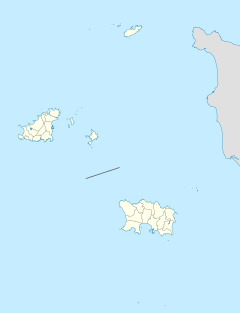
La Corbière (Jèrriais: La Corbiéthe) is the extreme south-western point of Jersey in St. Brelade. The name means "a place where crows gather", deriving from the word corbîn meaning crow. However, seagulls have long since displaced the crows from their coastal nesting sites.
The rocks and extreme tidal variation around this stretch of Jersey's coast have been treacherous for navigation and La Corbière has been the scene of many shipwrecks, including that of the mail packet "Express" on 20 September 1859.
Sited on the headland overlooking the lighthouse is a monument sculpted by Derek Tristram and erected in April 1997, to commemorate a rescue that took place. The accompanying plaque describes the event:
La Corbière was formerly the western terminus of the Jersey Railway line from Saint Helier. The first through train ran from Saint Helier to La Corbière on 5 August 1885. The service was unable to compete against motor buses and the railway closed in 1935. The States of Jersey purchased the railway track on 1 April 1937, and created a trail now known as the Railway Walk, linking La Corbière and Saint Aubin for pedestrians and cyclists. During the German military occupation 1940-45, the Germans re-established light railways for the purpose of supplying coastal fortifications. A one-metre gauge line was laid down following the route of the former Jersey Railway from Saint Helier to La Corbière, with a branch line connecting the stone quarry at Ronez in Saint John. The German railway infrastructure was dismantled after the Liberation in 1945, but other German fortifications remain, besides the communications tower, and can be seen around the headland.
The former railway platform can still be seen at the end of the Railway Walk at La Corbière and just opposite on the other side of the trail is La Table des Marthes, a megalith. The table-like stone was used historically as a meeting place for the witnessing of contracts and it is conjectured that the name is a corruption of la table des martyres ("martyr" being intended in its meaning of "witness"). Other theories have been put forward to explain the name and purpose of this stone.
...
Wikipedia

