Kuskokwim
| Kuskokwim River | |
|
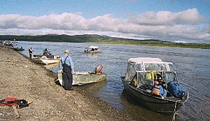
Shoreline of the Kuskokwim River at Aniak
|
|
| Name origin: from the Yup'ik, kusquqviim | |
| Country | United States |
|---|---|
| State | Alaska |
| District | Bethel Census Area, Yukon–Koyukuk Census Area |
| Source | confluence of the river's east and north forks |
| - location | near Medfra, Yukon–Koyukuk Census Area |
| - elevation | 3,655 ft (1,114 m) |
| - coordinates | 63°05′16″N 154°38′33″W / 63.08778°N 154.64250°W |
| Mouth | Kuskokwim Bay |
| - location | near Eek, Bethel Census Area |
| - elevation | 0 ft (0 m) |
| - coordinates | 60°04′59″N 162°20′02″W / 60.08306°N 162.33389°WCoordinates: 60°04′59″N 162°20′02″W / 60.08306°N 162.33389°W |
| Length | 702 mi (1,130 km) |
| Basin | 48,000 sq mi (124,319 km2) |
| Discharge | for mouth |
| - average | 67,000 cu ft/s (1,897 m3/s) |
|
Watershed of the Kuskokwim River in Alaska
|
|
The Kuskokwim River or Kusko River (Kusquqvak in Yup'ik) is a river, 702 miles (1,130 km) long, in Southwest Alaska in the United States. It is the ninth largest river in the United States by average discharge volume at its mouth and seventeenth largest by basin drainage area.
The river provides the principal drainage for an area of the remote Alaska Interior on the north and west side of the Alaska Range, flowing southwest into Kuskokwim Bay on the Bering Sea. The highest point in its watershed is Mount Russell. Except for its headwaters in the mountains, the river is broad and flat for its entire course, making it a useful transportation route for many types of watercraft, as well as road vehicles during the winter when it is frozen over. It is the longest free flowing river in the United States.
Kuskokwim is a loose transliteration of a Yup'ik word. It is a compound word meaning big slow moving thing.
The Alaska Natives of Kuskokwim are Yup'ik Eskimo on the lower Kuskokwim, Deg Hit'an Athabaskan on the middle Kuskokwim, Upper Kuskokwim Athabaskan on the upper Kuskokwim, and Koyukon Athabaskan on the North Fork, Lake Minchumina.
The river's name comes from the Yup'ik, kusquqviim, recorded by a Russian sailor in 1826. An obsolete Tanana (Athabaskan) name for the river was Chin-ana.Upper Kuskokwim (Kolchan) is often used to mean the people of the upper parts of the river, while Yup'ik people live along the lower river.
...
Wikipedia


