Kuk (New Guinea)

Satellite image of the wider Kuk Swamp area
|
|
| UNESCO World Heritage Site | |
|---|---|
| Location | Papua New Guinea |
| Coordinates | 5°47′1.36″S 144°19′54.2″E / 5.7837111°S 144.331722°ECoordinates: 5°47′1.36″S 144°19′54.2″E / 5.7837111°S 144.331722°E |
| Criteria | iii, iv |
| Reference | 887 |
| Inscription | 2008 (32nd Session) |
|
[]
|
|
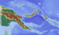
Kuk Swamp is an archaeological site in New Guinea, that lies in the Wahgi Valley of the highlands. The swamp developed in a former lake basin, as it was filled by an alluvial fan or deposits of water-transported material. Archeological evidence for early agricultural drainage systems was found here, beginning about 9,000 years ago. It includes draining ditches of three major classes, which were used to convert the area to an anthropogenic grassland. The native crop taro was grown here.
In addition, evidence of cultivation of bananas and sugar cane has been found, estimated to have begun 6,900 – 6,400 years ago. The Kuk Swamp was recognized in 2008 as a World Heritage Site by UNESCO. It was one of the places in the world where people independently developed agriculture.
The Kuk creek is believed to flow through the entirety of the fan to a catchment in the lower hills of the south region. Some channels were built to carry the water past the reach of the fan. If these channels were blocked, as evidence suggests, the area would develop as a swamp, diverting the water into smaller distributary channels. Evidence for early agricultural drainage systems was found here, beginning about 9,000 years ago. Features such as pits, postholes, and runnels have been found at the site, indicating evidence of early agriculture. Such features are consistent with planting, digging and tethering of plants.
In addition, evidence has been found of irrigation draining ditches, dating back to 9,000 years ago. A number of plants, including taro were grown, at what would have been the edge of its cultivable limit in the highlands. These ditches can be divided into three types: major disposal channels, large field ditches, and small field ditches. The major disposal channels were built to divert water from the fan flowing south and direct them toward the northeast areas. The large and small field ditches are more uniform, surrounding the perimeter of the planting areas. They connect with the major disposal channels. During this time, the people of Kuk Swamp transformed their landscape into an anthropogenic grassland suitable for agriculture.
During archaeological excavation of the drainage channels, researchers found artefacts including wooden digging sticks, a grindstone, and other small items. The ditches were cleaned out, and a small trench was dug to study the different layers of clay used to construct the ditches. These different layers suggest that the ditches were deliberately constructed by people.
...
Wikipedia

