Koh Tao
|
Ko Tao เกาะเต่า |
|
|---|---|

Shark Bay, on the island's south side
|
|
| Coordinates: 10°5′24″N 99°50′17″E / 10.09000°N 99.83806°E | |
| Country | Thailand |
| Province | Surat Thani |
| Area | |
| • Total | 21 km2 (8 sq mi) |
| Population | |
| • Total | 1,382 |
| Time zone | ICT (UTC+7) |
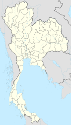
Ko Tao (also often Koh Tao, Thai: เกาะเต่า, Thai pronunciation: [kɔ̀ʔ tàw], lit. "Turtle Island") is an island in Thailand and forms part of the Chumphon Archipelago on the western shore of the Gulf of Thailand. It covers an area of about 21 km². Administratively it forms a district (amphoe) (as of 2013[update]) of Surat Thani Province. As of 2006[update] its official population was 1,382. The main settlement is Ban Mae Hat.
The economy of the island is almost exclusively centred on tourism, especially scuba diving.
Initially the island was uninhabited, with only the occasional fisherman from the neighbouring islands, looking for shelter in a storm or just resting before continuing on his journey.
It would appear from old maps and descriptions that this island was known by European cartographers and mariners as "Pulo Bardia", indicating that it was first settled by Malayo-Polynesian peoples. The old maps show a chain of three islands aligned north-south and lying off the east coast of the Malay Peninsula. The most northerly and smallest of these islands is marked P. Bardia, the name it had until the early 1900s. The best map example is by John Thornton from The English Pilot, the Third Book, dated 1701, but the specific map of the Gulf of Siam is dated around 1677. Also see maps of the East Indies by William Dampier c.1697. By modern standards of accuracy, the islands are poorly placed on early maps. Seventeenth century marine navigation and cartography used the "backstaff" which, in this area, was accurate to one degree of longitude, or around 60 nautical miles.
The Edinburgh Gazetteer, or Geographical Dictionary published in 1827 also mentions the island and provides a geographical position. In his 1852 book titled Narrative of a Residence in Siam. by Frederick Arthur Neale, the author describes the people and wildlife of Bardia. According to the account there were farms and even cows in a village on the bay lying on the west side of the island. The book includes a fanciful illustration of "Bardia" showing huts and palm trees.
...
Wikipedia

