Knott
| Knott | |
|---|---|

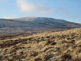
Knott from Lingy Hut
|
|
| Highest point | |
| Elevation | 710 m (2,330 ft) |
| Prominence | 242 m (794 ft) |
| Parent peak | Skiddaw |
| Listing | Marilyn, Hewitt, Wainwright, Nuttall |
| Coordinates | 54°41′10″N 3°05′37″W / 54.68621°N 3.09354°WCoordinates: 54°41′10″N 3°05′37″W / 54.68621°N 3.09354°W |
| Geography | |
| Location | Cumbria, England |
| Parent range | Lake District, Northern Fells |
| OS grid | NY296329 |
| Topo map | OS Landrangers 89, 90 |
Knott is a mountain in the northern part of the English Lake District. It is the highest point of the Back o'Skiddaw region, an area of wild and unfrequented moorland to the north of Skiddaw and Blencathra. Other tops in this region include High Pike, Carrock Fell and Great Calva. The fell's slopes are mostly smooth, gentle, and covered in grass, with a few deep ravines. It stands a long way from a road and requires a long walk across the moor top get to it; this, as well as the fact that it is hidden from the rest of the Lake District by the two aforementioned giants, make it one of the most unfrequented tops in the Lakes. When it is climbed it is most often from Mungrisdale or from the north via Great Sca Fell. The word Knott is of Cumbric origin, and means simply "hill".
Skiddaw and Blencathra are the best known of the Northern Fells, fronting the range as they loom above Keswick and the road to Penrith. Behind this wall is a further group of fells, commonly referred to as Back o' Skiddaw. Knott stands at the centre of this group, in addition to being the highest point.
The Back o'Skiddaw group is separated from Blencathra and the Skiddaw massif by Skiddaw Forest. Confusingly this Forest contains no trees — other than the windbreak of Skiddaw House — but is a marshy upland area at around 1,300 ft surrounded on all sides by higher fells. Three major streams flow from Skiddaw Forest, dividing the Northern Fells into three sectors. Dash Beck runs north-west, the River Caldew north-east and the River Glenderaterra south, between Skiddaw and Blencathra.
Knott itself is a long whale-backed ridge running for three miles in an east–west direction. With the exception of the extreme east and west, the fell has broad and gentle contours clad primarily in grass. Many of the streams draining it have cut deeply into Knott's flanks, exposing yellow and red soils which are visible in distant views.
...
Wikipedia

