Klein Matterhorn
| Klein Matterhorn | |
|---|---|

The Klein Matterhorn from the aerial tramway
|
|
| Highest point | |
| Elevation | 3,883 m (12,740 ft) |
| Prominence | 88 m (289 ft) |
| Parent peak | Breithorn |
| Coordinates | 45°56′18″N 7°43′47″E / 45.93833°N 7.72972°ECoordinates: 45°56′18″N 7°43′47″E / 45.93833°N 7.72972°E |
| Naming | |
| Translation | Little Matterhorn |
| Geography | |
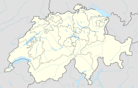
| Location | Zermatt, Valais, Switzerland |
| Parent range | Pennine Alps |
| Climbing | |
| First ascent | 1789 by Horace-Bénédict de Saussure |
| Easiest route | Aerial tramway |
The Klein Matterhorn (sometimes translated as Little Matterhorn) is a peak of the Pennine Alps, overlooking Zermatt in the Swiss canton of Valais. At 3,883 metres (12,740 ft) above sea level, it is the highest place in Europe that can be reached by aerial tramway, as well as by any other means of transport. The Klein Matterhorn is part of the Breithorn massif and overlooks on its south side the almost equally high flat glacier named Breithorn Plateau, just north of the international border with Italy. The name "Klein Matterhorn" is a reference to its much larger neighbour, the Matterhorn, which lies 7 km away across the Theodul Pass.
The Klein Matterhorn, with the adjacent ski-lifts to the slightly higher Gobba di Rollin, is also a year-round ski area, marketed as "Matterhorn Glacier Paradise", and part of the international ski area between Zermatt and Breuil-Cervinia.
Even before the construction license application was filed, the building promoter had to negotiate with the Swiss Alpine Club and with the Swiss Nature Conservation Society. These discussions resulted in two large natural reserve zones (the "Matterhorn" region and the "Monte Rosa" region). The third area (the "Schwarzsee-Theodul Glacier-Klein Matterhorn" region) was designated as a tourist zone.
Licensing was further delayed until 1969 by the citizens of Zermatt filing a complaint to the governing council of the Canton of Valais. In December 1970, the Swiss government finally gave permission for the cable way, but progress was further delayed until 1973 by objections from environmentalists. Eventually, on 17 December 1973, the Federal Council rejected objections and granted a construction license.
The next major obstacle proved to be the recruitment of a work force to build the lift system. At altitudes of 3000 to 4000m above sea level, worker productivity would be reduced by up to 50% compared to normal levels, and workers would be required to live for weeks on end within the camps.
The construction of this cable car started in August 1976 at all three construction sites: the valley terminal, the three tower sites and the mountain terminal. Creation of the mountain terminal was a difficult undertaking. Some 2000 cubic metres of concrete were used in the mountain station, all of which had to be transported there by helicopter in specially insulated tanks, mixed with warm water and 2% anti-freeze. Weather conditions at the work site (3,820 metres above sea level) in high mountain terrain were extreme: temperatures falling to minus 40 °C, snowfalls, and high winds of over 100 km/h.
...
Wikipedia

