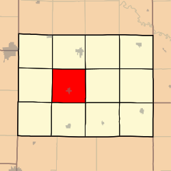
Kingston Township, Caldwell County, Missouri
| Kingston Township | |
|---|---|
| Township | |
 |
|
| Coordinates: 39°39′08″N 094°02′22″W / 39.65222°N 94.03944°WCoordinates: 39°39′08″N 094°02′22″W / 39.65222°N 94.03944°W | |
| Country | United States |
| State | Missouri |
| County | Caldwell |
| Area | |
| • Total | 35.21 sq mi (91.2 km2) |
| • Land | 35.21 sq mi (91.2 km2) |
| • Water | 0 sq mi (0 km2) 0% |
| Elevation | 807 ft (246 m) |
| Population (2000) | |
| • Total | 543 |
| • Density | 15.4/sq mi (6/km2) |
| FIPS code | 29-38864 |
| GNIS feature ID | 0766365 |
Kingston Township is one of twelve townships in Caldwell County, Missouri, USA. As of the 2000 census, its population was 543.
Kingston Township covers an area of 35.21 square miles (91.2 km2) and contains one incorporated settlement, Kingston (the county seat). It contains two cemeteries: Brown and Dustin.
The streams of Goose Creek, Jim Creek, Log Creek, Long Creek, Mill Creek and Tub Creek run through this township.
...
Wikipedia
