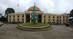
Kidapawan City, Cotabato
| Kidapawan Quidapauan |
||
|---|---|---|
| Component City | ||
| Lungsod ng Kidapawan (City of Kidapawan) | ||

City Hall
|
||
|
||
| Nickname(s): City of Fruits and Highland Springs; Spring in the Highlands; Second Fruit Basket of the Philippines; City at the Foot of Mt. Apo | ||
 Map of Cotabato with Kidapawan highlighted |
||
| Location within the Philippines | ||
| Coordinates: 7°01′N 125°05′E / 7.02°N 125.08°ECoordinates: 7°01′N 125°05′E / 7.02°N 125.08°E | ||
| Country | Philippines | |
| Region | SOCCSKSARGEN (Region XII) | |
| Province | Cotabato | |
| District | 2nd District of Cotabato | |
| Founded | August 18, 1947 | |
| Cityhood | February 12, 1998 | |
| Barangays | 40 | |
| Government | ||
| • Mayor | Joseph A. Evangelista | |
| Area | ||
| • Total | 358.47 km2 (138.41 sq mi) | |
| Elevation | 279 m (915 ft) | |
| Population (2015 census) | ||
| • Total | 140,195 | |
| • Density | 390/km2 (1,000/sq mi) | |
| • Languages | Cebuano, Hiligaynon, Filipino, English | |
| Demonym(s) | Kidapaweño | |
| Time zone | PST (UTC+8) | |
| ZIP code | 9400 | |
| IDD : area code | +63 (0)64 | |
| Income class | 3rd city income class | |
| 124704000 | ||
| Electorate | 75,080 voters as of 2016 | |
| Website | kidapawancity |
|
Kidapawan, officially the City of Kidapawan (Cebuano: Dakbayan sa Kidapawan; Hiligaynon: Dakbanwa/Syudad sang Kidapawan; Filipino: Lungsod ng Kidapawan) or often referred to as simply Kidapawan City, is the capital city of Cotabato Province. According to the 2015 census, it has a population of 140,195 people.
Located at the foot of Mount Apo, it is a popular destination from late October to December and in the summer, when thousands of tourists climb the country's highest mountain.
The word Kidapawan comes from the words tida, which means "spring", and pawan, which means "highland".
The first settlers around Kidapawan were predominantly Manobos. The influx of Christian settlers from Luzon and the Visayas resulted in the evolution of the word from 'Tidapawan' to 'Kidapawan'. Aside from the Manobos and Christians, Kidapawan was also home to the most prominent Muslims, including a Sultan (Sultan Omar Kiram II) who was a descendant of .
Kidapawan City was created by the Republic Act. No. 8500, signed by President Fidel V. Ramos on February 12, 1998, making it the first component city of Cotabato Province. The Act was ratified by a large majority by a plebiscite on March 21, 1998. It was originally named a district of Pikit.
In 1942, the Japanese Imperial forces entered Kidapawan. Three years later, local Filipino soldiers of the Philippine Commonwealth Army and Philippine Constabulary units and Moro guerrilla fighters taken to liberate Kidapawan fought the battles against the Japanese Imperial forces. Kidapawan was later declared a separate municipality by Executive Order No. 82 issued by President Manuel Roxas on August 18, 1947. It thus become the fourth town of the then Empire Province of Cotabato, composed previously of the municipalities of Cotabato (now Cotabato City), Dulawan (later named Datu Piang) and Midsayap.
Created along with the city were the twelve original barangays, namely: Birada, Ginatilan, Indangan, Linangcob, Luvimin, Manongol, Marbel, Mateo, Meohao, Mua-an, Perez, and Sibawan. From the original land area of 273, 262 hectares, Kidapawan retained only 34,007.20 hectares when four municipalities were created from it namely: Magpet (June 22, 1963, R.A. 3721), Matalam (Dec. 29, 1961, E.O. 461), M’lang (Aug. 3, 1951, E.O. 462) and President Roxas (May 8, 1967, R.A. 4869).
...
Wikipedia


