Khirbat Jiddin
| Khirbat Jiddin | |
|---|---|

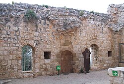
Khirbat Jiddin mosque
|
|
| Arabic | خربة جدّين |
| Subdistrict | Acre |
| Coordinates | 32°59′40″N 35°13′19″E / 32.99444°N 35.22194°ECoordinates: 32°59′40″N 35°13′19″E / 32.99444°N 35.22194°E |
| Palestine grid | 171/266 |
| Population | 1,500 (1945) |
| Area | 7,587 dunams |
| Date of depopulation | 11 July 1948 (Sheva' Brigade as part of Operation Dekel) |
| Cause(s) of depopulation | Military assault by Yishuv forces |
| Current localities | Yehiam, Kiryat, and Ga'aton |
Khirbat Jiddin (Arabic: خربة جدين), is the site of the Crusader castle of Judin, built by the Teutonic Order after 1220 in the western Upper Galilee, 16 km northeast of the city of Acre, which at the time was the capital of the Crusader kingdom. The castle was destroyed by the Mamluk sultan Baibars sometime between 1268-1271 and lay in ruins until being rebuilt and expanded by the Arab ruler Zahir al-Umar as Qal'at Jiddin ("Jiddin Castle") in the 1760s, only to be destroyed again around 1775 by Jazzar Pasha. The ruined fortress, known as Khirbat Jiddin (lit. "ruins of Jiddin"), was later inhabited by the al-Suwaytat Bedouin tribe.
According to a 1945 census, there were 1500 Muslims living in the area. Khirbat Jiddin land totaled 7587 dunums, of which however all but 34 were officially listed as non-cultivable; 4238 were owned by Arabs and 3349 dunums owned by Jews.Kibbutz Yehiam was established in the area in 1946. The establishment of the kibbutz is described on .
Today the remains of the castle are the central part of Yehi'am Fortress National Park.
The site was inhabited in the Byzantine period.
The Crusaders called the place Judin or Judyn. A Crusader castle was built there some time after May 1220, when the Teutonic Order acquired the nearby village of Shifaya. The village fell to Sultan Baibars between 1268 and 1271. In 1283, Burchard of Mount Sion described a destroyed castle on the site that had belonged to the Teutonic Order.
...
Wikipedia

