Khánh Hòa Province
|
Khánh Hòa Province Tỉnh Khánh Hòa |
|
|---|---|
| Province | |

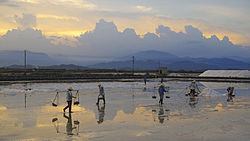
Salt production near Ninh Hòa
|
|
 Location of Khánh Hòa within Vietnam |
|
| Coordinates: 12°15′N 109°12′E / 12.250°N 109.200°ECoordinates: 12°15′N 109°12′E / 12.250°N 109.200°E | |
| Country |
|
| Region | South Central Coast |
| Capital | Nha Trang |
| Government | |
| • People's Committee Chair | Nguyễn Chiến Thắng |
| • People's Council Chair | Lê Thanh Quang |
| Area | |
| • Total | 5,217.6 km2 (2,014.5 sq mi) |
| Population (2009) | |
| • Total | 1,156,903 |
| • Density | 220/km2 (570/sq mi) |
| Demographics | |
| • Ethnicities | Kinh, Raglai, Hoa, Koho |
| Time zone | ICT (UTC+7) |
| Calling code | 58 |
| ISO 3166 code | VN-34 |
| Website | www |
Khánh Hòa (![]() ) is a province of Vietnam located in the South Central Coast. It has a population of 1,066,300 and spans an area of 5,197 km². Its capital is Nha Trang. Khánh Hòa is the site of Bảo Đại's summer home, the Pasteur Institute of Nha Trang, the Institute of Oceanography, the Institute of Vaccines and Biological Substances, and was headquarters of the US Army's Special Forces ("the Green Berets") during the Vietnam War in the late 1950s and 1960s. Cam Ranh Bay port is on land closest to a deep sea drop in Vietnam - the best site for submarine bases in Vietnam. An ancient temple of Champa is on the north side of Nha Trang.
) is a province of Vietnam located in the South Central Coast. It has a population of 1,066,300 and spans an area of 5,197 km². Its capital is Nha Trang. Khánh Hòa is the site of Bảo Đại's summer home, the Pasteur Institute of Nha Trang, the Institute of Oceanography, the Institute of Vaccines and Biological Substances, and was headquarters of the US Army's Special Forces ("the Green Berets") during the Vietnam War in the late 1950s and 1960s. Cam Ranh Bay port is on land closest to a deep sea drop in Vietnam - the best site for submarine bases in Vietnam. An ancient temple of Champa is on the north side of Nha Trang.
The site of what is now Khánh Hòa had been within the territory of the Champa Kingdom before it was annexed to Đại Việt's (Viet Nam's) territory. In 1653, one of the Nguyễn lords, Nguyễn Phúc Tần, sent his troops to occupy Phan Rang. The Champa king Bà Tấm surrendered to Nguyen's troops and ceded an area from the east of the Phan Rang River to Phú Yên to the Nguyễn lord. The Nguyễn lord accepted the ceded territory and set up the Thái Khang garrison and divided it into two districts: Thái Khang and Diên Ninh.
...
Wikipedia
