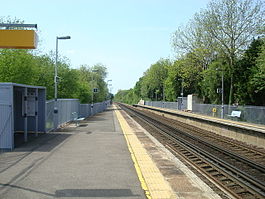
Kemsing railway station
| Kemsing |
|
|---|---|
 |
|
| Location | |
| Place | Kemsing |
| Local authority | Sevenoaks |
| Grid reference | TQ567577 |
| Operations | |
| Station code | KMS |
| Managed by | Southeastern |
| Number of platforms | 2 |
| DfT category | F2 |
| Live arrivals/departures, station information and onward connections from National Rail Enquiries |
|
| Annual rail passenger usage* | |
| 2011/12 |
|
| 2012/13 |
|
| 2013/14 |
|
| 2014/15 |
|
| 2015/16 |
|
| History | |
| Key dates | Opened 1 June 1874 |
| Original company | London, Chatham and Dover Railway |
| Pre-grouping | South Eastern and Chatham Railway |
| Post-grouping | Southern Railway |
| National Rail – UK railway stations | |
| * Annual estimated passenger usage based on sales of tickets in stated financial year(s) which end or originate at Kemsing from Office of Rail and Road statistics. Methodology may vary year on year. | |
|
|
|
Kemsing railway station serves Kemsing in Kent, England, although the station is located on the other side of the M26 motorway to the village. Train services are provided by Southeastern.
Kemsing station opened on 1 June 1874, as part of the Maidstone Line from Swanley to Maidstone The goods yard had six sidings, one of which served a goods shed. Freight facilities were withdrawn on 31 October 1960. The signal box closed on 30 September 1964.
The station has been unstaffed since 8 February 1985. The station buildings were demolished after the station became unstaffed. A PERTIS 'permit to travel' machine, located outside the station at road level on the 'up' side, suffices.
The typical off-peak service from the station is one train per hour to Ashford International via Maidstone East and one train per hour to London Victoria via Otford and Bromley South.
There is also a peak hour service via Thameslink across London, serving London Blackfriars, City Thameslink, Farringdon and St Pancras International before travelling on to Bedford. On Sundays all trains on the line pass through without stopping. Trains do however call on Bank holidays.
Coordinates: 51°17′49″N 0°14′49″E / 51.297°N 0.247°E
...
Wikipedia
