Kehrsatz
| Kehrsatz | ||
|---|---|---|

Kehrsatz village
|
||
|
||
| Coordinates: 46°55′N 7°28′E / 46.917°N 7.467°ECoordinates: 46°55′N 7°28′E / 46.917°N 7.467°E | ||
| Country | Switzerland | |
| Canton | Bern | |
| District | Bern-Mittelland | |
| Area | ||
| • Total | 4.44 km2 (1.71 sq mi) | |
| Elevation | 570 m (1,870 ft) | |
| Population (Dec 2015) | ||
| • Total | 4,226 | |
| • Density | 950/km2 (2,500/sq mi) | |
| Postal code | 3122 | |
| SFOS number | 0870 | |
| Surrounded by | Belp, Köniz, Muri bei Bern, Wald | |
| Website |
www SFSO statistics |
|
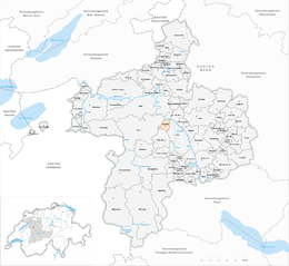
Kehrsatz is a municipality in the Bern-Mittelland administrative district in the canton of Bern in Switzerland.
Kehrsatz is first mentioned in 1281 as Kersaz.
The oldest trace of a settlement in the area are some La Tène graves which were discovered under Zimmerwaldstrasse 27. During the Roman era there was a well developed village of Gallo-Roman farm houses at the Maygut - Breitenacker area. A horde of Roman coins was also discovered in the Gurtental. By the Middle Ages the village was part of the Belp-Montenach Herrschaft. By the 13th century a number of Bernese nobles and local monasteries owned pieces of the village and surrounding farms. Gradually, Bern acquired a majority of rights in Kehrsatz and by the 15th century had the low court right over the village. In the following century their power expanded to include the Zwing or Twing rights.
In 1388, the village became part of the Bernese district of Seftigen. Kehrsatz Castle was built in the 14th century for the local administrator. It was rebuilt in the 16th century and renovated several times since then. Over the centuries, a number of Bernese patrician families ruled over Kehrsatz. This all changed following the 1798 French invasion, and creation of the Helvetic Republic. Kehrsatz became an independent municipality in the Canton of Bern. The Canton acquired the Castle and in 1888 turned it into a girls boarding school. Today it is a Cantonal boarding school.
...
Wikipedia


