Kapalong, Davao del Norte
| Kapalong | |
|---|---|
| Municipality | |
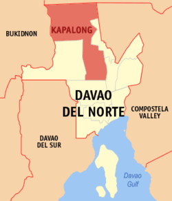
 Map of Davao del Norte with Kapalong highlighted |
|
| Location within the Philippines | |
| Coordinates: 07°45′N 125°30′E / 7.750°N 125.500°ECoordinates: 07°45′N 125°30′E / 7.750°N 125.500°E | |
| Country | Philippines |
| Region | Davao (Region XI) |
| Province | Davao del Norte |
| District | 1st district of Davao del Norte |
| Established | July 8, 1948 |
| Barangays | 14 |
| Government | |
| • Mayor | Edgardo Timbol |
| Area | |
| • Total | 830.01 km2 (320.47 sq mi) |
| Population (2015 census) | |
| • Total | 76,334 |
| • Density | 92/km2 (240/sq mi) |
| Time zone | PST (UTC+8) |
| ZIP code | 8113 |
| IDD : area code | +63 (0)84 |
| Income class | 1st municipal income class |
| 112305000 | |
| Electorate | 39,565 voters as of 2016 |
| Website | www |
Kapalong is a 1st class municipality in the province of Davao del Norte, Philippines. According to the 2015 census, it has a population of 76,334 people.
The town was founded in July 8, 1948, from the Municipal District of Tagum, which was formed in 1918. It was one of the oldest towns in Davao del Norte Province, others being Tagum, in 1941; and Panabo, in 1949, both of which were converted into cities almost 50 years later. Though the towns of Santo Tomas, Talaingod and portion of San Isidro emerged from Kapalong in 1959, 1991, and 2004 respectively, it is still the largest town by land area in the province of Davao del Norte.
Kapalong is politically subdivided into 14 barangays.
...
Wikipedia

