Kaligandaki Gorge
| Kali Gandaki Gorge | |
|---|---|

Kali Gandaki Gorge near Ghassa village, Nepal
|
|
| Floor elevation | approx. 2,520 metres (8,270 ft) |
| Long-axis direction | N-S |
| Long-axis length | ? |
| Width | ? |
| Geography | |
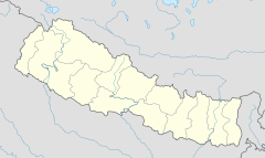
| Coordinates | 28°42′24″N 83°38′43″E / 28.7068°N 83.6453°ECoordinates: 28°42′24″N 83°38′43″E / 28.7068°N 83.6453°E |
The Kali Gandaki Gorge or Andha Galchi is the gorge of the Kali Gandaki (or Gandaki River) in the Himalayas in Nepal. By some measures the Kali Gandaki gorge is the deepest canyon in the world, being 5,571 m or 18,278 ft lower than Annapurna I which bounds it at one point. However, this definition is based on difference in elevation alone, and only a fraction of it results from erosion often associated with canyons. Gorge depth is difficult to define due to disagreement over rim height so this claim is disputed.
The upper part of the gorge is also called Thak Khola after the local Thakali people who became prosperous from trans-Himalayan trade. Geologically, the gorge is within a structural graben.
The gorge separates the major peaks of Dhaulagiri (8,167 m or 26,795 ft) on the west and Annapurna (8,091 m or 26,545 ft) on the east. If one measures the depth of a canyon by the difference between the river height and the heights of the highest peaks on either side, the gorge is the world's deepest. The portion of the river directly between Dhaulagiri and Annapurna I (7 km downstream from Tukuche) is at an elevation of 2,520 m or 8,270 ft, 5,571 m or 18,278 ft lower than Annapurna I. As tectonic activity forced the mountains higher, the river cut down through the uplift. This region is known for shaligram fossils, revered as one of five non-living forms of Lord Vishnu.
The Kali Gandaki river source coincides with the Tibetan border and Ganges-Brahmaputra watershed divide. The river then flows south through the ancient kingdom of Mustang. It flows through a sheer-sided, deep canyon immediately south of the Mustang capital of Lo Manthang, then widens as it approaches Kagbeni where high Himalayan ranges begin to close in. The river continues southward past Jomsom, Marpha, and Tukuche to the deepest part of the gorge about 7 km south of Tukuche in the area of Lete. The gorge then broadens past Dana and Tatopani toward Beni.
...
Wikipedia

