Kahuzi-Biéga National Park
| Kahuzi-Biéga National Park | |
|---|---|
|
IUCN category II (national park)
|
|

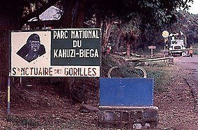
Park entrance
|
|
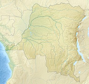
| Location within the Democratic Republic of the Congo | |
| Location | Democratic Republic of the Congo |
| Coordinates | 2°30′0″S 28°45′0″E / 2.50000°S 28.75000°ECoordinates: 2°30′0″S 28°45′0″E / 2.50000°S 28.75000°E |
| Area | 6,000 km² |
| Established | 1970 |
| Governing body | l'Institut Congolais pour la Conservation de la Nature (ICCN) |
| Type | Natural |
| Criteria | x |
| Designated | 1980 (4th session) |
| Reference no. | 137 |
| State Party | Democratic Republic of the Congo |
| Region | Africa |
| Endangered | 1997–present |
The Kahuzi-Biega National Park is a protected area near Bukavu town in eastern Democratic Republic of the Congo. It is situated near the western bank of Lake Kivu and the Rwandan border. Established in 1970 by the Belgian photographer and conservationist Adrien Deschryver, the park is named after two dormant volcanoes, Mount Kahuzi and Mount Biega, which are within its limits. With an area of 6,000 square kilometres (2,300 sq mi), Kahuzi-Biega is one of the biggest national parks in the country. Set in both mountainous and lowland terrain, it is one of the last refuges of the rare species of Eastern lowland gorilla (Gorilla beringei graueri), an endangered category under the IUCN Red List. The park is a UNESCO World Heritage Site, inscribed in 1980 for its unique biodiversity of rainforest habitat and its eastern lowland gorillas.
The park lies west of the Bakavu town in South Kivu Province, covering an area of 6000 km2. A small part of the park is in Mitumba Mountain range of the Albertine Rift in the Great Rift Valley, and the larger part is in lowland terrain. A corridor of 7.4 kilometres (4.6 mi) width joins the mountainous and lowland terrain. The eastern part of the park is the smaller mountainous region measuring 600 square kilometres (230 sq mi); the larger part measures 5,400 square kilometres (2,100 sq mi) and consists mainly of lowland stretching from Bukavu to Kisangani, drained by the Luka and Lugulu rivers which flow into the Lualaba River. Two dormant volcanoes are set within the park's limits and lend their names to it: Kahuzi (3,308 metres (10,853 ft)) and Biéga (2,790 metres (9,150 ft)).
...
Wikipedia

