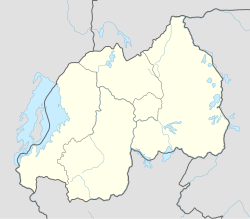
Kabgayi
| Kabgayi | |
|---|---|

Suburban View with Kabgayi Cathedral in Distance
|
|
| Location in Rwanda | |
| Coordinates: 2°06′03″S 29°45′08″E / 2.100718°S 29.752243°ECoordinates: 2°06′03″S 29°45′08″E / 2.100718°S 29.752243°E | |
| Country |
|
| Province | Southern Province |
| District | Muhanga District |
| City | Gitarama |
| Elevation | 5,945 ft (1,812 m) |
Kabgayi is just south of Gitarama in Muhanga District, Southern Province, Rwanda, 25 miles (40 km) southwest of Kigali. It was established as a Catholic Church mission in 1905. It became the center for the Roman Catholic Church in Rwanda and is the site of the oldest cathedral in the country and of Catholic seminaries, schools and a hospital. The church at first supported the Tutsi ruling elite, but later backed the Hutu majority. During the 1994 Rwandan Genocide thousands of Tutsis who had taken refuge here were killed. Some survivors admire the courage of many priests who helped them during those difficult days,like Father Evergiste RUKEBESHA and many others. Later, some Hutus including three bishops and many priests were killed by the rebels RPF soldiers. A mass grave beside the hospital is marked by a memorial.
Kabgayi lies in the middle of Rwanda's central plateau at an elevation of about 6,000 feet (1,800 m) above sea level. The community is just south of Gitarama, the second-largest city in Rwanda, and about 30 kilometres (19 mi) from Kigali, the capital. It has a mild and temperate climate. There are two rainy seasons. Average annual rainfall is 1,000 to 1,100 millimetres (39 to 43 in). Estimated annual evapotranspiration is about 815 millimetres (32.1 in). The soil is sandy and relatively infertile. As of 2002 most of the people in the surrounding Kabgayi district were engaged in farming. Only a few of the wealthier households could afford to own cattle.
The Kingdom of Rwanda before the European colonial powers arrived was ruled by a Tutsi elite of about 15% of the population over a Hutu peasant class of about 85%. Both are thought to have migrated from elsewhere at some time in the past, the Tutsis from the east and the Hutu from the north. The stereotype is that the Tutsis were tall and slim while the Hutus were shorter and sturdier. The Tutsis were cattle-owners with a warrior tradition and the Hutus were farmers. The two groups shared a common language, kinyarwanda. Wealthy Hutus had married into the Tutsi ruling class, and many Tutsis were poor farmers with no cattle, but there were still social distinctions that set the Tutsis above the Hutus at the start of the colonial era.
...
Wikipedia

