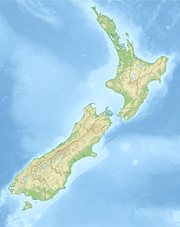
June 2011 Christchurch earthquake

Map showing the epicentre of the earthquake
|
|
| Date | 14:20:50, 13 June 2011 (+12:00) |
|---|---|
| Magnitude | 6.3 ML |
| Depth | 6 km (4 mi) |
| Epicenter | 43°34′S 172°44′E / 43.56°S 172.74°ECoordinates: 43°34′S 172°44′E / 43.56°S 172.74°E |
| Type | Strike-slip |
| Areas affected | New Zealand |
| Total damage | Building collapse, power outages, broken water pipes, soil liquefaction, rockfall |
| Max. intensity | VIII - Destructive |
| Peak acceleration | 0.78g (city); 2.13g (epicentre) |
| Tsunami | No |
| Casualties | 1 dead, 46 injured (2 critically) |
The June 2011 Christchurch earthquake was a shallow magnitude 6.3 ML earthquake that occurred on 13 June 2011 at 14:20 NZST (02:20 UTC). It was centred at a depth of 6 km (3.8 mi), about 10 km (6 mi) from Christchurch, which had previously been devastated by another magnitude 6.3 ML earthquake in February 2011. The June quake was preceded by a magnitude 5.9 ML tremor that struck the region at a slightly deeper 8.9 km (5.5 mi). The United States Geological Survey reported a magnitude of 6.0 Mw at a depth of about 9 km (5.6 mi).
The earthquake produced severe shaking that registered VIII on the Mercalli scale in and around the city of Christchurch, destroying some buildings and causing additional damage to many structures affected by previous earthquakes. The damaged tower of the historic Lyttelton Timeball Station collapsed before dismantling work could be completed. The earthquake downed phone lines and triggered widespread outages, which left around 54,000 households without power. Rebuilding costs in Christchurch increased by NZ$6 billion (US$4.8 billion) owing to the additional damage from the quake. Forty-six people suffered injuries, and one elderly man died after being knocked unconscious.
New Zealand in its entirety, particularly the North Island, is located along the seismically volatile Pacific Ring of Fire, and has a long history of earthquakes. Since the European settlement, the largest on record was a magnitude 8.2 ML major earthquake that occurred on 23 January 1855 near the Wairarapa plains of the North Island. Another destructive magnitude 7.8 ML earthquake struck the region near Hawke's Bay on 3 February 1931; it is the deadliest earthquake recorded on the island to date, greatly affecting much of Napier and Hastings.
...
Wikipedia

