Jumla Airport
| Jumla Airport | |||||||||||
|---|---|---|---|---|---|---|---|---|---|---|---|
| Summary | |||||||||||
| Airport type | Public | ||||||||||
| Serves | Jumla, Nepal | ||||||||||
| Elevation AMSL | 7,700 ft / 2,347 m | ||||||||||
| Coordinates | 29°16′27″N 82°11′36″E / 29.27417°N 82.19333°E | ||||||||||
| Map | |||||||||||
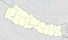
| Location of airport in Nepal | |||||||||||
| Runways | |||||||||||
|
|||||||||||
|
Sources:
|
|||||||||||
Coordinates: 29°16′28″N 082°11′36″E / 29.27444°N 82.19333°E
Jumla Airport (IATA: JUM, ICAO: VNJL) is an airport serving Jumla, the capital of the Jumla District in Province No. 6 in Nepal. The airport is capable to handle aircraft from the Nepalese Army Air Service.
The airport resides at an elevation of 7,700 feet (2,347 m) above mean sea level. It has one asphalt paved runway designated 09/27 which measures 531 by 25 metres (1,742 ft × 82 ft).
...
Wikipedia

