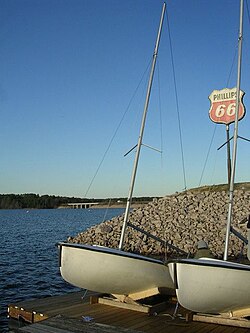
Jordan Lake
| B. Everett Jordan Lake | |
|---|---|
 |
|
| Location | Chatham / Durham counties, North Carolina, United States |
| Coordinates | 35°45′0″N 79°1′30″W / 35.75000°N 79.02500°WCoordinates: 35°45′0″N 79°1′30″W / 35.75000°N 79.02500°W |
| Lake type | Reservoir |
| Primary inflows | Haw River, New Hope Creek, Morgan Creek, and Little Creek |
| Primary outflows | Haw River |
| Basin countries | United States |
| Managing agency | United States Army Corps of Engineers |
| Max. length | 16 miles (26 km) |
| Max. width | 5 miles (8.0 km) |
| Surface area | 13,940 acres (56.4 km2) 31,800 acres (129 km2) flood control pool |
| Average depth | 14 feet (4.3 m) |
| Max. depth | 38 feet (12 m) |
| Water volume | 45,800 acre feet (56.5 hm3) |
| Shore length1 | 180 mi (290 km) |
| Surface elevation | 216 ft (66 m) |
| Frozen | never |
| 1 Shore length is not a well-defined measure. | |
B. Everett Jordan Lake is a reservoir in New Hope Valley, west of Raleigh and south of Durham in Chatham County, North Carolina, in the United States; the northernmost end of the lake extends into southwestern Durham County.
Part of the Jordan Lake State Recreation Area,the reservoir covers 13,940 acres (5,640 ha) with a shoreline of 180 miles (290 km) at its standard water level of 216 feet (66 m) above sea level. It was developed as part of a flood control project prompted by a particularly damaging tropical storm that hit the region downstream in September 1945. Constructed at an original cost of US $146,300,000, it is owned and operated by the United States Army Corps of Engineers, which dammed and flooded the Haw River and New Hope River between 1973 and 1983.
The Jordan Lake Dam (also known as the B. Everett Jordan Project and the New Hope Dam) is located at 35°39′15″N 79°4′0″W / 35.65417°N 79.06667°W 4 miles (6 km) upstream from the mouth of the Haw River in the upper Cape Fear River drainage basin. Completed in 1974 by the Nello L. Teer Company, it is 1,330 feet (405 m) in length and has a top elevation of 266.5 feet (81 m) above mean sea level.
...
Wikipedia
