Jomsom Airport
| Jomsom Airport | |||||||||||
|---|---|---|---|---|---|---|---|---|---|---|---|
 |
|||||||||||
| Summary | |||||||||||
| Airport type | Public | ||||||||||
| Serves | Jomsom, Nepal | ||||||||||
| Elevation AMSL | 8,976 ft / 2,736 m | ||||||||||
| Coordinates | 28°46′56″N 83°43′21″E / 28.78222°N 83.72250°E | ||||||||||
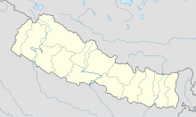
| Map | |||||||||||
| Location of airport in Nepal | |||||||||||
| Runways | |||||||||||
|
|||||||||||
|
Sources:
|
|||||||||||
Jomsom Airport (IATA: JMO, ICAO: VNJS) is an airport serving Jomsom, a town in the Mustang District of Province No. 4 in Nepal, and the Mustang District. It serves as the gateway to the Mustang District that includes Jomsom, Kagbeni, Tangbe, and Lo Manthang, and to Muktinath temple, which is a popular pilgrimage for Nepalis and Indians. The airport is capable of handling aircraft from the Nepalese Army Air Service.
There are daily flights between Pokhara and Jomsom during daylight hours in good weather. Although the flying distance is short and flight time just 20 minutes, very high mountains between Pokhara and Jomsom require planes to fly through the Kali Gandaki River gorge with major peaks that include Dhaulagiri (8,167 m or 26,795 ft) and Tukuche (6,920 m or 22,703 ft) on the west and Nilgiri Central (6,940 m or 22,769 ft) and Annapurna (8,091 m or 26,545 ft) on the east. With Jomsom airport located at the head of the gorge, high terrain surrounding the airport presents a hazard when a go-around is required and when, as is frequently necessary after mid-morning, a turn is required at Jomsom to land into southerly winds. Cloud may occur in Jomsom while it is fine in Pokhara, in Pokhara while it is fine in Jomsom, or between the two airports; and heat from the sun in the Mustang District causes strong southerly winds in the Kali Gandaki River gorge and at Jomsom after early morning. Cloud cover, changing visibility, and high winds, often mean flights are delayed or the airport closed.
...
Wikipedia

