John Muir Trail
| John Muir Trail | |
|---|---|
 |
|
| Length | 210.4 mi (338.6 km) |
| Location | California, United States |
| Trailheads |
Happy Isles trailhead, Yosemite Valley Summit of Mount Whitney |
| Use | backpacking, hiking, trail running, trail riding, pack trains |
| Elevation | |
| Elevation change | 47,000 ft (14,000 m) |
| Highest point | Mount Whitney, 14,505 ft (4,421 m) |
| Lowest point | Happy Isles trailhead, Yosemite Valley, 4,035 ft (1,230 m) |
| Hiking details | |
| Trail difficulty | Moderate to strenuous |
| Months | July to September |
| Sights | Yosemite Valley, Devils Postpile National Monument, Sierra Nevada |
| Hazards | Snowmelt, icy slopes early season, altitude |
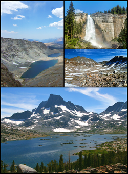
The John Muir Trail (JMT) is a long-distance trail in the Sierra Nevada mountain range of California, passing through Yosemite, Kings Canyon and Sequoia National Parks. From the northern terminus at Happy Isles in Yosemite Valley (37°43′54″N 119°33′31″W / 37.7317°N 119.5587°W) and the southern terminus located on the summit of Mount Whitney (36°34′43″N 118°17′31″W / 36.5785°N 118.292°W), the Trail's official length is 210.4 miles (338.6 km), with an elevation gain of approximately 47,000 feet (14,000 m). For almost all of its length, the trail is in the High Sierra backcountry and wilderness areas. For about 160 miles (260 km), the trail, named for naturalist John Muir, follows the same footpath as the longer Pacific Crest Trail.
...
Wikipedia
