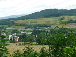
Jeřmanice
| Jeřmanice | |
|---|---|
| Municipality | |
 |
|
| Coordinates: 50°41′59″N 15°5′38″E / 50.69972°N 15.09389°ECoordinates: 50°41′59″N 15°5′38″E / 50.69972°N 15.09389°E | |
| Country |
|
| Region | Liberec |
| District | Liberec |
| Area | |
| • Total | 4.37 km2 (1.69 sq mi) |
| Elevation | 456 m (1,496 ft) |
| Population (2013) | |
| • Total | 481 |
| • Density | 110/km2 (290/sq mi) |
| Postal code | 463 12 |
Jeřmanice is a village and municipality (obec) in Liberec District in the Liberec Region of the Czech Republic. The municipality covers an area of 4.37 square kilometers (1.69 sq mi) and has a population of 481 (as of 2013).
The first written mention of the village dates from 1543.
The town lies on the railway line from Pardubice to Liberec. It is also on the R35 expressway.
...
Wikipedia

