Iuka, Mississippi
| Iuka, Mississippi | |
|---|---|
| City | |

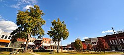
Historic downtown Iuka in November, 2013.
|
|
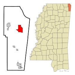
 Location of Iuka, Mississippi |
|
| Location in the United States | |
| Coordinates: 34°48′38″N 88°11′45″W / 34.81056°N 88.19583°WCoordinates: 34°48′38″N 88°11′45″W / 34.81056°N 88.19583°W | |
| Country | United States |
| State | Mississippi |
| County | Tishomingo |
| Government | |
| • Mayor | John Castleberry |
| Area | |
| • Total | 9.7 sq mi (25.0 km2) |
| • Land | 9.7 sq mi (25.0 km2) |
| • Water | 0.0 sq mi (0.0 km2) |
| Elevation | 561 ft (171 m) |
| Population (2000) | |
| • Total | 3,059 |
| • Density | 316.6/sq mi (122.3/km2) |
| Time zone | Central (CST) (UTC-6) |
| • Summer (DST) | CDT (UTC-5) |
| ZIP code | 38852 |
| Area code(s) | 662 Exchanges: 423,424 |
| FIPS code | 28-35300 |
| GNIS feature ID | 0671750 |
Iuka is the county seat of Tishomingo County,Mississippi, United States. The population was 3,059 at the 2000 census. Woodall Mountain, the highest point in Mississippi, is located just south of Iuka.
Iuka is built on the site of a Chickasaw Indian village that is thought to have been subordinate to the settlement at Underwood Village. The name "Iuka" comes from the name of one of the chieftains of the village. Iuka was founded by David Hubbard, a wagon train scout.
Euro-American settlers arrived with the Memphis and Charleston Railroad in 1857. Before the American Civil War, the town boasted an all-female college, a boys' military academy, and a fine hotel. The Civil War brought widespread devastation when a major engagement here occurred on September 19, 1862. The Battle of Iuka resulted in 1200 to 1500 killed or wounded. The dead Confederate soldiers were buried in a long trench that eventually became Shady Grove Cemetery.
The first normal school built in the former Confederacy after the Civil War, Iuka Normal Institute, was built here. However, the town did not return to prosperity for many years. The building of Pickwick Landing Dam and Pickwick Lake by the Tennessee Valley Authority brought activity back to the town.
In 1904, water from Iuka's mineral springs won first prize for the purest and best mineral water at the World's Fair in St. Louis.
Iuka is located at 34°48′38″N 88°11′45″W / 34.81056°N 88.19583°W (34.810633, -88.195759).
...
Wikipedia

