Isleworth, Middlesex
| Isleworth | |
|---|---|
 Osterley House (NT) |
|
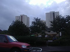
 High rise flats close to the Twickenham border |
|
| Isleworth shown within Greater London | |
| Area | 8.31 km2 (3.21 sq mi) |
| Population | 25,008 (Isleworth, Osterley and Spring Grove wards 2011) |
| • Density | 3,009/km2 (7,790/sq mi) |
| OS grid reference | TQ1575 |
| Civil parish |
|
| London borough | |
| Ceremonial county | Greater London |
| Region | |
| Country | England |
| Sovereign state | United Kingdom |
| Post town | ISLEWORTH |
| Postcode district | TW7 |
| Dialling code | 020 |
| Police | Metropolitan |
| Fire | London |
| Ambulance | London |
| EU Parliament | London |
| UK Parliament | |
| London Assembly | |
Isleworth (/ˈaɪzəlwərθ/ EYE-zəl-wərth) is a small town of Saxon origin sited within the London Borough of Hounslow in west London, England. It lies immediately east of the town of Hounslow and west of the River Thames and its tributary the River Crane. Isleworth's original area of settlement, alongside the Thames, is known as 'Old Isleworth'. The north-west corner of the town, bordering on Osterley to the north and Lampton to the west, is known as 'Spring Grove'.
Isleworth's former Thames frontage of approximately one mile, excluding that of the Syon estate, was reduced to little over half a mile in 1994 when a borough boundary realignment was effected in order to unite the district of St Margaret's wholly within London Borough of Richmond upon Thames. As a result, most of Isleworth's riverside is that part overlooking the 8.6-acre (3.5 ha) islet of Isleworth Ait: the short-length River Crane flows into the Thames south of the Ait, and its artificial distributary the Duke of Northumberland's River west of the Ait, one of two Colne distributaries constructed for aesthetic reasons in the 1600–1750 period.
Excavations around the eastern end of the Syon Park estate have unearthed evidence of a Romano-British settlement. 'Gislheresuuyrth', meaning in Old English Enclosure belonging to [a man called] Gīslhere, is first referred to as a permanent settlement in an Anglo-Saxon charter in the year 695.The Domesday Book says that during the reign (1042–1066) of Edward the Confessor the manor belonged to Earl Algar (Anglo-Saxon spelling probably Ælfgār), and a modern road off South St today carries his name.
...
Wikipedia

