Isle of Hope, Georgia
| Isle of Hope, Georgia | |
|---|---|
| Census-designated place | |
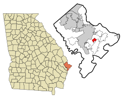
 Location in Chatham County and the state of Georgia |
|
| Coordinates: 31°59′0″N 81°3′20″W / 31.98333°N 81.05556°WCoordinates: 31°59′0″N 81°3′20″W / 31.98333°N 81.05556°W | |
| Country | United States |
| State | Georgia |
| County | Chatham |
| Area | |
| • Total | 2.3 sq mi (5.9 km2) |
| • Land | 1.8 sq mi (4.7 km2) |
| • Water | 0.5 sq mi (1.2 km2) |
| Elevation | 13 ft (4 m) |
| Population (2010) | |
| • Total | 2,402 |
| • Density | 1,327/sq mi (512.4/km2) |
| Time zone | Eastern (EST) (UTC-5) |
| • Summer (DST) | EDT (UTC-4) |
| FIPS code | 13-41484 |
| GNIS feature ID | 0332069 |
Isle of Hope is a census-designated place (CDP) in Chatham County, Georgia, United States. It is part of the Savannah Metropolitan Statistical Area, and at the 2010 census, its population was 2,402. The island is one of the most affluent communities in the state and is well known for its historic plantations and exclusive waterfront properties.
Isle of Hope is located southeast of Savannah at 31°59′0″N 81°3′20″W / 31.98333°N 81.05556°W (31.983380, -81.055686). It consists of the northern half of the physical Isle of Hope, a body of land surrounded by tidal inlets: the Moon River and Herb River to the northwest, Grimball Creek to the northeast, and the Skidaway River and Skidaway Narrows, part of the Intracoastal Waterway, to the southeast. The CDP is bordered by the Dutch Island CDP to the northeast and the Skidaway Island CDP to the southeast. The Isle of Hope CDP includes the communities of Parkersburg and Wymberley.
According to the United States Census Bureau, the CDP has a total area of 2.3 square miles (5.9 km2), of which 1.8 square miles (4.7 km2) of it is land and 0.46 square miles (1.2 km2), or 20.61%, is water.
As of the census of 2000, there were 2,605 people, 1,001 households, and 783 families residing in the CDP. The population density was 1,373.2 people per square mile (529.4/km²). There were 1,038 housing units at an average density of 547.2 per square mile (210.9/km²). The racial makeup of the CDP was 98.27% White, 0.84% African American, 0.35% Asian, 0.27% from other races, and 0.27% from two or more races. Hispanic or Latino of any race were 1.07% of the population.
...
Wikipedia
