Isle Brewers
| Isle Brewers | |
|---|---|
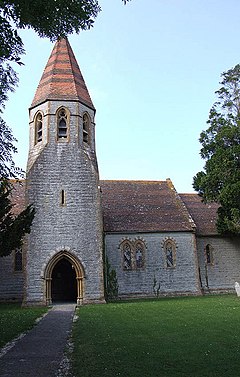
 All Saints church |
|
 River Isle from bridge,looking south |
|
| Isle Brewers shown within Somerset | |
| Population | 150 (2011) |
| OS grid reference | ST368211 |
| District | |
| Shire county | |
| Region | |
| Country | England |
| Sovereign state | United Kingdom |
| Post town | Taunton |
| Postcode district | TA3 |
| Dialling code | 01460 |
| Police | Avon and Somerset |
| Fire | Devon and Somerset |
| Ambulance | South Western |
| EU Parliament | South West England |
| UK Parliament | |
Isle Brewers is a village and parish in Somerset, England, situated on the River Isle 7 miles (11.3 km) south east of Taunton in the South Somerset district. The village has a population of 150. The parish includes the hamlet of North Bradon.
The first part of the name of the village comes from the River Isle, which separates the parish from Isle Abbotts and the second from the family of William Brewer (Briwere) who were the lords of the manor in the early 13th century.
The parish council has responsibility for local issues, including setting an annual precept (local rate) to cover the council’s operating costs and producing annual accounts for public scrutiny. The parish council evaluates local planning applications and works with the local police, district council officers, and neighbourhood watch groups on matters of crime, security, and traffic. The parish council's role also includes initiating projects for the maintenance and repair of parish facilities, as well as consulting with the district council on the maintenance, repair, and improvement of highways, drainage, footpaths, public transport, and street cleaning. Conservation matters (including trees and listed buildings) and environmental issues are also the responsibility of the council.
The village falls within the Non-metropolitan district of South Somerset, which was formed on 1 April 1974 under the Local Government Act 1972, having previously been part of Langport Rural District. The district council is responsible for local planning and building control, local roads, council housing, environmental health, markets and fairs, refuse collection and recycling, cemeteries and crematoria, leisure services, parks, and tourism.
...
Wikipedia

