Isla del Frio

Isla del Frio, Ponce, Puerto Rico, taken looking SW from the shores of the municipality of Juana Diaz
|
|
| Geography | |
|---|---|
| Location | Ponce, Puerto Rico |
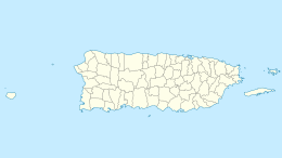
| Coordinates | 17°57′43″N 66°33′22″W / 17.96194°N 66.55611°W |
| Area | 0.01 km2 (0.0039 sq mi) |
| Administration | |
|
United States
|
|
| Commonwealth | Puerto Rico |
| Municipality | Ponce |
| Demographics | |
| Population | 0 |
| Pop. density | 0 /km2 (0 /sq mi) |
Coordinates: 17°57′43″N 66°33′22″W / 17.96194°N 66.55611°W
Isla del Frío is a small uninhabited island off the southern coast of Puerto Rico. Together with Caja de Muertos, Gatas, Morrillito, Ratones, Cardona, and Isla de Jueyes, Isla del Frío is one of seven islands ascribed to the municipality of Ponce. Like Isla de Jueyes, the island is considered part of barrio Vayas.
The island, sometimes erroneously considered a cay (or, key), and sometimes errouneously spelled Isla del Erio, is located approximately 300 meters (980 ft) south of the mainland Puerto Rican shore at the mouth of Rio Inabon. The closest populated point on the mainland is Hacienda Villa Esperanza, located in barrio Vayas; however the closest geographic point on the mainland is barrio Capitanejo in Ponce. The island has an area of 2.89 cuerdas (one cuerda equals 0.97 acres). It is located at latitude 17.96444° and longitude -66.55639°.
...
Wikipedia

