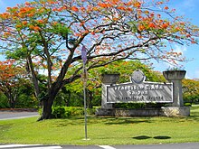
Isely Field
|
Saipan International Airport Francisco C. Ada Airport |
|||||||||||||||
|---|---|---|---|---|---|---|---|---|---|---|---|---|---|---|---|
 |
|||||||||||||||
| Summary | |||||||||||||||
| Airport type | Public | ||||||||||||||
| Owner | Commonwealth Ports Authority | ||||||||||||||
| Location | Saipan, Northern Mariana Islands | ||||||||||||||
| Elevation AMSL | 215 ft / 66 m | ||||||||||||||
| Coordinates | 15°07′08″N 145°43′46″E / 15.11889°N 145.72944°E | ||||||||||||||
| Website | cpa |
||||||||||||||
| Runways | |||||||||||||||
|
|||||||||||||||
| Statistics (2005) | |||||||||||||||
|
|||||||||||||||
|
Source: Federal Aviation Administration
|
|||||||||||||||
| Aircraft operations | 39,542 |
|---|---|
| Based aircraft | 22 |
Saipan International Airport (IATA: SPN, ICAO: PGSN, FAA LID: GSN), also known as Francisco C. Ada/Saipan International Airport, is a public airport located on Saipan Island in the United States Commonwealth of the Northern Mariana Islands. The airport is owned by Commonwealth Ports Authority. Its airfield was previously known as Aslito (during the Japanese South Pacific Mandate) and Isley Field (during the American World War II and later period).
This airport is assigned a three-letter location identifier of GSN by the Federal Aviation Administration, but the International Air Transport Association (IATA) airport code is SPN (the IATA assigned GSN to Mount Gunson Airport in Australia).
Saipan International Airport was a sugarcane field before the Imperial Japanese Navy Air Service (IJNAS) constructed a temporary landing field on the site in 1933. The landing field was used for training purposes and had two runways configured in an "L" pattern. In 1937, the Navy began upgrading the airfield for full military use, despite an international law ban on constructing military facilities within the South Pacific Mandate. Following the attack against the United States in 1941, the field was named Aslito Field (アスリート飛行場), based on the indigenous Chamoru name for the area of its location, As Lito.
...
Wikipedia
