Iowa River
| Iowa River | |
|---|---|

The Iowa River upstream of Marshalltown, Iowa
|
|

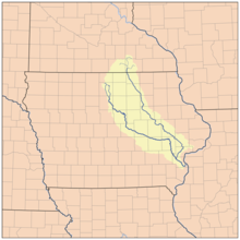
Map showing the Cedar (to the right) and Iowa (to the left) rivers
|
|
| Basin features | |
| River mouth | Confluence with the Mississippi River |
| Tributaries |
|
| Physical characteristics | |
| Length | 323 mi (520 km) |
The Iowa River is a tributary of the Mississippi River in the state of Iowa in the United States. It is about 323 miles (520 km) long and is open to small river craft to Iowa City, about 65 miles (105 km) from its mouth. Its major tributary is the Cedar River.
It rises in two branches, the West Branch and East Branch, both of which have their headwaters in Hancock County, each about 38 miles (61 km) long and which join in Belmond.
The Iowa then proceeds roughly in a southeast direction, passing through the city of Iowa Falls, through a scenic valley to Steamboat Rock, then through the cities of Eldora, Marshalltown, Tama, and Marengo, and through the Amana Colonies in Iowa County. In Johnson County, it becomes impounded by the Coralville Dam in the Coralville Reservoir, which turns southward to the spillway. The river runs generally south and passes through Iowa City and the University of Iowa campus. A lowhead dam at Burlington Street in Iowa City is the last dam before the river's confluence with the Mississippi. South of Iowa City, it is joined in Washington County by the English River, and then in Louisa County it is joined by the Cedar River to flow into the Mississippi.
...
Wikipedia
