Innaloo
|
Innaloo Perth, Western Australia |
|||||||||||||
|---|---|---|---|---|---|---|---|---|---|---|---|---|---|

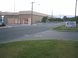
Oswald Street
|
|||||||||||||
| Coordinates | 31°53′38″S 115°47′28″E / 31.894°S 115.791°ECoordinates: 31°53′38″S 115°47′28″E / 31.894°S 115.791°E | ||||||||||||
| Population | 7,648 (2011 census) | ||||||||||||
| • Density | 2,550/km2 (6,600/sq mi) | ||||||||||||
| Established | 1950s | ||||||||||||
| Postcode(s) | 6018 | ||||||||||||
| Area | 3.0 km2 (1.2 sq mi) | ||||||||||||
| Location | 9 km (6 mi) NNE of Perth CBD | ||||||||||||
| LGA(s) | City of Stirling | ||||||||||||
| State electorate(s) | Scarborough | ||||||||||||
| Federal Division(s) | Curtin | ||||||||||||
|
|||||||||||||
Innaloo is a suburb of Perth, the capital city of Western Australia 9 km from Perth's central business district in the local government area is the City of Stirling.
Innaloo is a more established residential suburb that is also home to the Westfield Innaloo and Westfield Innaloo Megacentre shopping centres, and is adjacent to Perth's largest cinema complex, the 18-cinema Greater Union Megaplex Innaloo.
Innaloo was originally named "Njookenbooroo", a local Noongar Aboriginal name for a nearby swamp. This name was too difficult to pronounce or spell, and in 1927, the local progress association asked welfare worker and anthropologist Daisy Bates to compile a list of words and names. The name of an Aboriginal woman from Dongara was chosen for the area. It is much beloved of comedians making fun of place names, along with the suburb of Upper Swan. However, all attempts at changing the name from Innaloo have so far failed.
Land near Innaloo was first granted to Thomas Mews in 1831. In 1898, Town Properties of WA subdivided the lands around Njookenbooroo Swamp for sale as market gardens and drained the swamp into Herdsman Lake over the following years, digging channels through the area to facilitate agriculture. They offered rent-free lease of the lots with an option to later purchase at £100 per hectare if the occupants cleared them and brought them into production. The area between Hertha Road, Oswald Street and King Edward Road and Herdsman Lake was gazetted as the Njookenbooroo Drainage District, and by 1912, local market gardeners were turning off 25 tonnes of produce each week, even considering the vagaries of the weather and occasional pests. The Njookenbooroo School on Odin Road (then called Government Road), linked to the city by a plank road, was built in 1915. Although subdivision for southern Innaloo was approved in 1916, by the 1920s only ten houses had been built, with the majority of the land used for grazing. Residential development accelerated during World War II, and in the 1950s, Metro-Goldwyn-Mayer (MGM) built a drive-in cinema in nearby Liege Street.
...
Wikipedia

