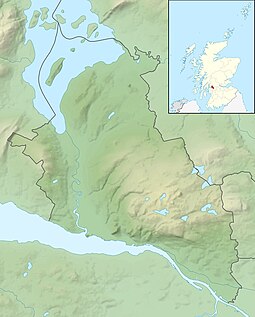
Inchmurrin
| Gaelic name | Innis Mheadhran |
|---|---|
| Meaning of name | St Mirin's Island |
| Location | |
|
Inchmurrin shown within West Dunbartonshire
|
|
| OS grid reference | NS379871 |
| Coordinates | 56°03′N 4°36′W / 56.05°N 4.60°W |
| Physical geography | |
| Island group | Loch Lomond |
| Area | 120 hectares (0.46 sq mi) |
| Area rank | 139= (Freshwater: 1) |
| Highest elevation | 89 metres (292 ft) |
| Administration | |
| Sovereign state | United Kingdom |
| Country | Scotland |
| Council area | West Dunbartonshire |
| Demographics | |
| Population | 8 |
| Population rank | 70= (Freshwater: 1) |
| Population density | 6 people/km2 |
| References | |
Inchmurrin (Scottish Gaelic: Innis Mheadhran) is an island in Loch Lomond in Scotland. It is the largest fresh water island in the British Isles.
Inchmurrin is the largest and most southerly of the islands in Loch Lomond. It reaches a height of 89 metres (292 ft) towards the north and is largely wooded. There is an excellent view of the north end of the loch.
Along with Creinch, Torrinch, and Inchcailloch, Inchmurrin forms part of the Highland boundary fault.
Inchmurrin was the site of a 7th-century monastery, with a chapel dedicated to Saint Mirin, after whom it was named.
The island was formerly a deer park of the Dukes of Montrose, who had a hunting lodge built in 1793 and maintained a gamekeeper and his family there. 200 deer are recorded in 1800. There are ruins of Lennox Castle, probably built for Duncan, 8th Earl of Lennox whose seat was Balloch Castle at the south end of Loch Lomond. The castle was probably a hunting lodge for the deer park established on the island by King Robert I of Scotland in the early 14th century. After her husband Murdoch Stewart, Duke of Albany, father Donnchadh, Earl of Lennox, and two sons were executed by James I in 1425, Isabella Countess of Lennox retired to the castle on Inchmurrin with her grandchildren.
...
Wikipedia

