Imperial County Airport
|
Imperial County Airport Boley Field |
|||||||||||||||
|---|---|---|---|---|---|---|---|---|---|---|---|---|---|---|---|
| Summary | |||||||||||||||
| Airport type | Public | ||||||||||||||
| Owner | Imperial County | ||||||||||||||
| Serves | Imperial / El Centro | ||||||||||||||
| Location | Imperial County, California | ||||||||||||||
| Elevation AMSL | -54 ft / -16 m | ||||||||||||||
| Coordinates | 32°50′03″N 115°34′43″W / 32.83417°N 115.57861°WCoordinates: 32°50′03″N 115°34′43″W / 32.83417°N 115.57861°W | ||||||||||||||
| Website | www.co.imperial.ca.us/... | ||||||||||||||
| Map | |||||||||||||||
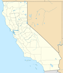
| Location of airport in California | |||||||||||||||
| Runways | |||||||||||||||
|
|||||||||||||||
| Statistics (2011) | |||||||||||||||
|
|||||||||||||||
|
Source: Federal Aviation Administration
|
|||||||||||||||
| Aircraft operations | 14,589 |
|---|---|
| Based aircraft | 47 |
Imperial County Airport (IATA: IPL, ICAO: KIPL, FAA LID: IPL) is a county-owned public-use airport in Imperial County, California, United States. Also known as Boley Field, it is mostly used for general aviation, but has scheduled passenger service from one commercial airline. Service is subsidized by the Essential Air Service program.
The airport is located one nautical mile (2 km) south of the central business district of Imperial, California, partially in the City of Imperial and partially in an unincorporated area of Imperial County. It serves nearby communities, including El Centro.
As per the Federal Aviation Administration, this airport had 7,061 passenger boardings (enplanements) in calendar year 2008, 5,641 in 2009, and 4,752 in 2010. The National Plan of Integrated Airport Systems for 2011–2015 categorized it as a non-primary commercial service airport.
The first scheduled passenger airline flights were operated by Western Airlines with Douglas DC-3s with service beginning during the late 1940s. Western's service was followed by Bonanza Air Lines in the early 1950s also flying DC-3s.
...
Wikipedia

