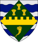
Huntingdonshire
| Huntingdonshire | |||
|---|---|---|---|
| Non-metropolitan district, historic county | |||
|
|||
 Huntingdonshire shown within Cambridgeshire |
|||
| Sovereign state | United Kingdom | ||
| Constituent country | England | ||
| Region | East of England | ||
| Non-metropolitan county | Cambridgeshire | ||
| Status | Non-metropolitan district | ||
| Admin HQ | Huntingdon | ||
| Incorporated | 1 April 1974 | ||
| Government | |||
| • Type | Non-metropolitan district council | ||
| • Body | Huntingdonshire District Council | ||
| • Leadership | Leader & Cabinet (Conservative) | ||
| • MPs |
Jonathan Djanogly Shailesh Vara |
||
| Area | |||
| • Total | 352.3 sq mi (912.5 km2) | ||
| Area rank | 35th (of 326) | ||
| Population (mid-2015 est.) | |||
| • Total | 175,000 | ||
| • Rank | 105th (of 326) | ||
| • Density | 500/sq mi (190/km2) | ||
| • Ethnicity | 94.6% White 1.8% S.Asian 1.3% Black 1.4% Mixed Race |
||
| Time zone | GMT (UTC0) | ||
| • Summer (DST) | BST (UTC+1) | ||
| ONS code | 12UE (ONS) E07000011 (GSS) |
||
| OS grid reference | TL1900381334 | ||
| Website | www |
||
Huntingdonshire (/ˈhʌntɪŋdənʃə/ or /ˈhʌntɪŋdənʃɪər/; abbreviated Hunts) is a non-metropolitan district of Cambridgeshire, as well as a historic county of England. Its council is based in Huntingdon and the district also includes the towns of St Ives, Godmanchester, St Neots and Ramsey. The district population was recorded as 169,508 at the 2011 Census.
The area corresponding to modern Huntingdonshire was first delimited in Anglo-Saxon times, and the modern boundaries have remained largely unchanged since the 10th century, though it lost its county status in 1974.
In 1889, under the Local Government Act 1888 Huntingdonshire became an administrative county, with the new County Council taking over administrative functions from the Quarter Sessions. The area in the north of the county forming part of the municipal borough of Peterborough became instead part of the Soke of Peterborough administrative county, in Northamptonshire.
...
Wikipedia


