Houston County Airport (Tennessee)
| Houston County Airport | |||||||||||
|---|---|---|---|---|---|---|---|---|---|---|---|
| Summary | |||||||||||
| Airport type | Public | ||||||||||
| Owner | Houston County | ||||||||||
| Location | McKinnon, Tennessee | ||||||||||
| Elevation AMSL | 370 ft / 113 m | ||||||||||
| Coordinates | 36°19′00″N 087°55′00″W / 36.31667°N 87.91667°W | ||||||||||
| Map | |||||||||||
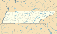
| Location of airport in Tennessee | |||||||||||
| Runways | |||||||||||
|
|||||||||||
| Statistics (1999) | |||||||||||
|
|||||||||||
|
Source: Federal Aviation Administration
|
|||||||||||
| Aircraft operations | 1,730 |
|---|
Houston County Airport (FAA LID: M93) is a public airport located in McKinnon, in Houston County, Tennessee, United States. It is owned by Houston County.
Houston County Airport covers an area of 84 acres (34 ha) which contains one asphalt paved runway, 8/26, measuring 3,000 x 75 ft (914 x 23 m).
For the 12-month period ending December 27, 1999, the airport had 1,730 aircraft operations: 86% general aviation and 14% military.
...
Wikipedia

