Horne, Surrey
| Horne | |
|---|---|
 Church of St Mary the Virgin |
|
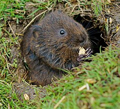
 A water vole at the British Wildlife Centre |
|
| Horne shown within Surrey | |
| Area | 14.19 km2 (5.48 sq mi) |
| Population | 811 (civil parish 2011) |
| • Density | 57/km2 (150/sq mi) |
| OS grid reference | TQ3344 |
| Civil parish |
|
| District | |
| Shire county | |
| Region | |
| Country | England |
| Sovereign state | United Kingdom |
| Post town | HORLEY |
| Postcode district | RH6 |
| Dialling code | 01342 |
| Police | Surrey |
| Fire | Surrey |
| Ambulance | South East Coast |
| EU Parliament | South East England |
| UK Parliament | |
Horne is a rural village and civil parish in the District of Tandridge in Surrey, England. The parish includes the hamlet of Newchapel and is home to the British Wildlife Centre. Eastern fields forming a narrow part of the parish are split by the A22 road, a main road to East Grinstead.
The civil parish covers 1,419 hectares (3,510 acres) and is centred 4.6 miles (7.4 km) east of Horley, 4.2 miles (6.8 km) west of Lingfield, 8.0 miles (12.9 km) SSW of Oxted, and 22.0 miles (35.4 km) south-east of Kingston upon Thames. At the 2011 Census the civil parish included the population of Newchapel
A British (Celtic) gold coin has been found in Horne, but is more probably a mark of transit than of settlement. Otherwise there are no prehistoric remains, such as are usually found in other Wealden parishes. Horne must have owed such importance as it had later to the iron industry.
The parish lay within the Anglo-Saxon Tandridge hundred, where the wealthy and powerful would meet periodically at a level below that of the shire to decide on strategic matters, and later for settling disputes in the Hundred Court. The earliest reference to Horne by name was in the 12th century. Horne had a chapelry and manor but did not become a parish until 1705, from the southernmost part of Bletchingley (parish).
...
Wikipedia

