Hornchurch Urban District
| Hornchurch | |
|---|---|
| Urban district | |

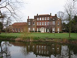
Langtons House was used as the council offices from 1929.
|
|
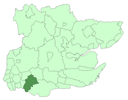
 Hornchurch within Essex in 1961 |
|
| Area | |
| • 1931 | 6,783 acres (27.4 km2) |
| • 1961 | 19,768 acres (80.0 km2) |
| Population | |
| • 1931 | 28,417 |
| • 1961 | 131,014 |
| Density | |
| • 1931 | 4/acre |
| • 1961 | 6.6/acre |
| History | |
| • Origin | Hornchurch civil parish |
| • Created | 1926 |
| • Abolished | 1965 |
| • Succeeded by | London Borough of Havering |
| Status | Urban district |
| Government | Hornchurch Urban District Council |
| • HQ | Langtons House, Hornchurch |
| • Motto | A good name endureth |
 Coat of arms of Hornchurch Urban District Council |
|
Hornchurch was a local government district in southwest Essex from 1926 to 1965, formed as an urban district for the civil parish of Hornchurch. It was greatly expanded in 1934 with the addition of Cranham, Great Warley, Rainham, Upminster and Wennington; and in 1935 by gaining North Ockendon. Hornchurch Urban District Council was based at Langtons House in Hornchurch from 1929. The district formed a suburb of London and with a population peaking at 131,014 in 1961, it was one of the largest districts of its type in England. It now forms the greater part of the London Borough of Havering in Greater London.
The ancient parish of Hornchurch had been coterminous with the liberty and manor of Havering since its formation in antiquity. Havering-atte-Bower and Romford formed chapelries and were split off as parishes in the 1790s and 1849 respectively.
The liberty was abolished in 1892; although by this date in Hornchurch it had already been superseded by various ad-hoc bodies, such as the Romford Poor Law Union and the Romford Rural Sanitary District.
The Hornchurch parish passed to Romford Rural District in 1894 and formed part of the London Traffic Area from 1924.
The civil parish of Hornchurch became an urban district in 1926. It included Harold Wood in the northeast and stretched south through the town of Hornchurch to South Hornchurch and the River Thames.
Following the Local Government Act 1929, as part of a county review order in 1934 the urban district was extended to the east, by gaining 11,687 acres (47.30 km2) from Romford Rural District. This area corresponded to all of the Rainham and Wennington parishes and the greater part of Upminster, Cranham and Great Warley. There was a small loss of territory to Romford in the northwest where the urban district came close Romford town centre. As part of another county review order in 1935 it was enlarged by gaining 1,326 acres (5.37 km2) of North Ockendon from Orsett Rural District.
...
Wikipedia
