Hooksett, New Hampshire
| Hooksett, New Hampshire | ||
|---|---|---|
| Town | ||

Hooksett Village from the Pinnacle
|
||
|
||
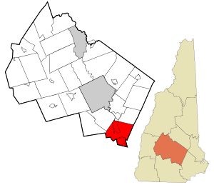
 Location in Merrimack County and the state of New Hampshire |
||
| Coordinates: 43°05′48″N 71°27′54″W / 43.09667°N 71.46500°WCoordinates: 43°05′48″N 71°27′54″W / 43.09667°N 71.46500°W | ||
| Country | United States | |
| State | New Hampshire | |
| County | Merrimack | |
| Incorporated | 1822 | |
| Government | ||
| • Town Council | Timothy Tsantoulis Robert Duhaime James A. Levesque Marc Miville Donald Winterton John Giotas David Ross Adam Jennings James Sullivan |
|
| • Town Administrator | Dean E. Shankle, Jr. | |
| Area | ||
| • Total | 37.5 sq mi (97.1 km2) | |
| • Land | 36.4 sq mi (94.4 km2) | |
| • Water | 1.0 sq mi (2.7 km2) 2.71% | |
| Elevation | 213 ft (65 m) | |
| Population (2010) | ||
| • Total | 13,451 | |
| • Density | 369/sq mi (142.4/km2) | |
| Time zone | Eastern (UTC-5) | |
| • Summer (DST) | Eastern (UTC-4) | |
| ZIP code | 03106 | |
| Area code(s) | 603 | |
| FIPS code | 33-37300 | |
| GNIS feature ID | 0873629 | |
| Website | www |
|
Hooksett is a town in Merrimack County, New Hampshire, United States. The population was 13,451 at the 2010 census. The town is located between Manchester, the state's largest city, and Concord, the state capital. A prominent landmark is Robie's Country Store, a National Historic Landmark and a frequent stop for presidential candidates during the New Hampshire primary.
The central village in town, where 4,147 people resided at the 2010 census, is defined as the Hooksett census-designated place and is located at a bridge crossing of the Merrimack River. The town also contains the census-designated place of South Hooksett.
Hooksett was incorporated in 1822. First known as Chester Woods and Rowe's Corner, this town was called Hooksett for nearly fifty years before being incorporated. The name may have come from a hook-shaped island in the Merrimack or from early fishermen, who called the area Hookline Falls. Rocky ledges flank the Merrimack River, and there were several cross-river ferries located here, as well as lumber mills and a brick-making establishment powered by the falls. In 1794, the lottery-funded Hooksett Canal became part of the transportation facilities of the Amoskeag cotton mills in Manchester. The first census, taken in 1830, reported 880 residents.
Hooksett is situated on the Merrimack River in south-central New Hampshire. Interstate 93 connects Hooksett to the White Mountains and Boston. Hooksett lies fully within the Merrimack River watershed.
According to the United States Census Bureau, the town has a total area of 37.5 square miles (97.1 km2), of which 36.4 square miles (94.4 km2) is land and 1.0 square mile (2.7 km2) is water, comprising 2.76% of the town. Hooksett village, a census-designated place in the northern part of town, has a total area of 5.2 square miles (13.4 km2), of which 4.8 square miles (12.4 km2) is land and 0.39 square miles (1.0 km2), or 7.43%, is water.
...
Wikipedia

