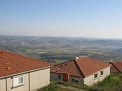
Homesh
|
Homesh חֹמֶשׁ حومش |
|
|---|---|
 |
|
| Coordinates: 32°18′29.03″N 35°11′33.2″E / 32.3080639°N 35.192556°ECoordinates: 32°18′29.03″N 35°11′33.2″E / 32.3080639°N 35.192556°E | |
| District | Judea and Samaria Area |
| Council | Shomron |
| Region | West Bank |
| Affiliation | Mishkei Herut Beitar |
| Founded | 1978 |
| Population (2005) | 70 families |
| Name meaning | Named after 5 villages that were in the area during the time of the Mishnah and the Talmud. |
Homesh (Hebrew: חֹמֶשׁ, חומש) was a community settlement and Israeli settlement in the northern Samarian hills of the West Bank along Route 60. The village fell under the administrative jurisdiction of the Shomron Regional Council. In 2005, the town's Jewish community was evicted and their homes were demolished, as part of the Israeli disengagement from Gaza and four settlements in the northern West Bank.
The international community considers Israeli settlements in the West Bank illegal under international law, but the Israeli government disputes this.
The village was established in 1978 on 173 acres (700 dunams) of confiscated land belonging to the nearby Palestinian village of Burqa, whose ownership was certified in the land registry. It began as a pioneer Nahal military outpost, and demilitarized when turned over to residential purposes in 1980 to secular Jews. During the Second Intifada about half of the residents left. Shortly thereafter, dozens of Orthodox Jews moved to the village in order to show support for the continued settlement of the area. The Homesh Yeshiva has endeavoured to retain some hold on the area by sleeping in nearby caves. The IDF maintained a requisition order to impede Palestinians from returning to the land for eight years, and only rescinded it when the case came up before the Supreme Court in 2013. Palestinian owners are now replanting the area, and a rise in attempts by Jewish extremists to wrest back control is expected.
...
Wikipedia

