Hollis, Oklahoma
| Hollis, Oklahoma | |
|---|---|
| City | |
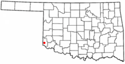
 Location of Hollis, Oklahoma |
|
| Coordinates: 34°41′11″N 99°55′1″W / 34.68639°N 99.91694°WCoordinates: 34°41′11″N 99°55′1″W / 34.68639°N 99.91694°W | |
| Country | United States |
| State | Oklahoma |
| County | Harmon |
| Government | |
| • Type | Council-manager |
| Area | |
| • Total | 1.4 sq mi (3.7 km2) |
| • Land | 1.4 sq mi (3.7 km2) |
| • Water | 0.0 sq mi (0.0 km2) |
| Elevation | 1,627 ft (496 m) |
| Population (2010) | |
| • Total | 2,060 |
| • Density | 1,589.8/sq mi (613.8/km2) |
| Time zone | Central (CST) (UTC-6) |
| • Summer (DST) | CDT (UTC-5) |
| ZIP code | 73550 |
| Area code(s) | 580 |
| FIPS code | 40-35500 |
| GNIS feature ID | 1093847 |
Hollis is a city in and the county seat of Harmon County, Oklahoma, United States. The population was 2,060 at the 2010 census.
The city was named for George W. Hollis, a local businessman and member of the townsite committee that laid out the town in 1898, while the site was still in old Greer County, Texas. The original plat was lost, and after a lawsuit, the town was re-platted in 1903. The original business district comprised a general store opened by George Hollis and a blacksmith shop owned by Jim Prock. A post office named for Hollis was established October 31, 1901.
Hollis was in Greer County, Oklahoma until 1909, when Governor Haskell divided the old county into Greer County and Harmon County, Hollis fell into Harmon County. An election was held to choose a county seat. Contenders were Hollis, Dryden, Looney and Vinson. Hollis won the election.
Hollis is located at 34°41′11″N 99°55′1″W / 34.68639°N 99.91694°W (34.686374, -99.916889). According to the United States Census Bureau, the city has a total area of 1.4 square miles (3.6 km2), all land.
Hollis experiences a dry humid subtropical climate (Köppen Cfa) with cool, dry winters and hot, much wetter summers.
As of the census of 2000, there were 2,264 people, 845 households, and 561 families residing in the city. The population density was 1,589.8 people per square mile (615.6/km²). There were 1,081 housing units at an average density of 759.1/sq mi (293.9/km²). The racial makeup of the city was 66.65% White, 12.68% African American, 0.84% Native American, 0.22% Asian, 17.67% from other races, and 1.94% from two or more races. 28.18% of the population were Hispanic or Latino of any race.
...
Wikipedia
