Hohentannen
| Hohentannen | ||
|---|---|---|
|
||
| Coordinates: 47°30′N 9°13′E / 47.500°N 9.217°ECoordinates: 47°30′N 9°13′E / 47.500°N 9.217°E | ||
| Country | Switzerland | |
| Canton | Thurgau | |
| District | Weinfelden | |
| Area | ||
| • Total | 8.0 km2 (3.1 sq mi) | |
| Elevation | 570 m (1,870 ft) | |
| Population (Dec 2015) | ||
| • Total | 616 | |
| • Density | 77/km2 (200/sq mi) | |
| Postal code | 9216 | |
| SFOS number | 4495 | |
| Surrounded by | Bischofszell, Erlen, Kradolf-Schönenberg, Sulgen, Zihlschlacht-Sitterdorf | |
| Website |
www SFSO statistics |
|
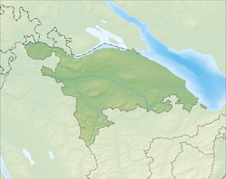
Hohentannen is a municipality in Weinfelden District in the canton of Thurgau in Switzerland.
Hohentannen is first mentioned in 1256 as Hontannon. In 1275 it was mentioned as in Hohentannun. From the Middle Ages until 1798, the lower courts were granted as a fief by the Bishop of Constance to Heidelberg. Hohentannen, Sitterdorf, Heidelberg and Oetlishausen all belonged to the parish of Bischofszell. In 1812 Heidelberg and Oetlishausen joined the municipality of Hohentannen, followed in 1874, by the hamlet of Hummelberg. Hohentannen was formerly on the Sulgen-Bischofszell road, but since the road moved into the valley in 1823 the village has been located off any major road. Agricultural and viticulture were replaced at the end of the 19th Century by cattle and dairy farming. By 1900, small embroidery businesses were common in the village. Today, the gravel pits are a source of income. Despite the construction of single-family houses Hohentannen has preserved its character as a farming village.
Hohentannen has an area, as of 2009[update], of 8 square kilometers (3.1 sq mi). Of this area, 5.86 km2 (2.26 sq mi) or 73.3% is used for agricultural purposes, while 1.38 km2 (0.53 sq mi) or 17.3% is forested. Of the rest of the land, 0.65 km2 (0.25 sq mi) or 8.1% is settled (buildings or roads), 0.1 km2 (25 acres) or 1.3% is either rivers or lakes.
Of the built up area, industrial buildings made up 3.3% of the total area while housing and buildings made up 0.1% and transportation infrastructure made up 2.3%. while parks, green belts and sports fields made up 2.5%. Out of the forested land, 16.1% of the total land area is heavily forested and 1.1% is covered with orchards or small clusters of trees. Of the agricultural land, 58.4% is used for growing crops, while 14.9% is used for orchards or vine crops. All the water in the municipality is flowing water.
...
Wikipedia


