Hochstetter Foreland
| Native name: Nunat Dronning Margrethe II |
|
|---|---|

Queen Margrethe II Land in the southeast
|
|
| Geography | |
| Location | East Greenland |
| Coordinates | 75°40′N 21°0′W / 75.667°N 21.000°WCoordinates: 75°40′N 21°0′W / 75.667°N 21.000°W |
| Adjacent bodies of water | |
| Length | 112 km (69.6 mi) |
| Width | 65 km (40.4 mi) |
| Highest elevation | 1,756 m (5,761 ft) |
| Administration | |
|
Greenland (Denmark)
|
|
| Zone | NE Greenland National Park |
| Demographics | |
| Population | Uninhabited |
Queen Margrethe II Land (Danish: Dronning Margrethe II Land) is a peninsula in the northern limit of King Christian X Land, northeastern Greenland. Administratively it belongs to the NE Greenland National Park area.
The peninsula was named after Queen Margrethe II of Denmark on 16 April 1990 on the occasion of her 50th birthday.
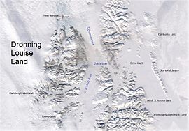
Queen Margrethe II Land is bounded in the west by the Ejnar Mikkelsen Glacier, in the north by the Bessel Fjord, in the east by the Greenland Sea, in the southeast by the Shannon Sound —with Shannon Island across it to the east, and in the south by the Ardencaple Fjord and the Bredefjord. Adolf S. Jensen Land lies to the north of the Bessel Fjord. Haystack is the peninsula's easternmost point.
The peninsula has two distinct parts:
The highest elevation of Queen Margrethe II Land is a 1,756 m (5,761 ft) high unnamed mountain in the southern part of Norlund Land. The main mountains in the peninsula are Møbius Bjerg and Schneekoppe in the north and the Barth Range, Matterhorn and Wildspitze in the southern area.
...
Wikipedia

