Higden, Arkansas
| Higden, Arkansas | |
|---|---|
| Town | |
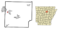
 Location in Cleburne County and the state of Arkansas |
|
| Coordinates: 35°34′15″N 92°12′13″W / 35.57083°N 92.20361°WCoordinates: 35°34′15″N 92°12′13″W / 35.57083°N 92.20361°W | |
| Country | United States |
| State | Arkansas |
| County | Cleburne |
| Area | |
| • Total | 0.5 sq mi (1.2 km2) |
| • Land | 0.5 sq mi (1.2 km2) |
| • Water | 0 sq mi (0 km2) |
| Elevation | 525 ft (160 m) |
| Population (2010) | |
| • Total | 120 |
| • Density | 250/sq mi (96.6/km2) |
| Time zone | Central (CST) (UTC-6) |
| • Summer (DST) | CDT (UTC-5) |
| ZIP code | 72067 |
| Area code(s) | 501 |
| FIPS code | 05-32080 |
| GNIS feature ID | 0050091 |
Higden is a town in Cleburne County, Arkansas, United States. The population was 120 at the 2010 census.
Higden is located in western Cleburne County at 35°34′15″N 92°12′13″W / 35.57083°N 92.20361°W (35.570949, -92.203544), on the south and west shores of Greers Ferry Lake, a reservoir on the Little Red River. Arkansas Highways 16 and 92 run along the southern edge of the town and cross the lake at The Narrows, connecting Higden to Greers Ferry on the east shore.
According to the United States Census Bureau, Higden has a total area of 0.46 square miles (1.2 km2), all land.
Before Greers Ferry Lake was built, Higden moved to a hill. Some area residents claim that some homes and buildings are still underwater today in the lake.
As of the census of 2000, there were 101 people, 52 households, and 34 families residing in the town. The population density was 86.7/km² (225.7/mi²). There were 141 housing units at an average density of 121.0/km² (315.1/mi²). The racial makeup of the town was 94.06% White, 2.97% Native American, 0.99% from other races, and 1.98% from two or more races. 4.95% of the population were Hispanic or Latino of any race.
...
Wikipedia
