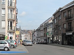
Herve
| Herve | |||
|---|---|---|---|
| Municipality | |||
 |
|||
|
|||
| Location in Belgium | |||
| Coordinates: 50°38′N 05°48′E / 50.633°N 5.800°ECoordinates: 50°38′N 05°48′E / 50.633°N 5.800°E | |||
| Country | Belgium | ||
| Community | French Community | ||
| Region | Wallonia | ||
| Province | Liège | ||
| Arrondissement | Verviers | ||
| Government | |||
| • Mayor | Pierre-Yves Jeholet (MR) | ||
| • Governing party/ies | HDM | ||
| Area | |||
| • Total | 56.84 km2 (21.95 sq mi) | ||
| Population (1 January 2016) | |||
| • Total | 17,533 | ||
| • Density | 310/km2 (800/sq mi) | ||
| Postal codes | 4650-4654 | ||
| Area codes | 087 | ||
| Website | www.herve.be | ||
Herve is a Walloon municipality of Belgium in Province of Liège. On January 1, 2006 Herve had a total population of 16,772. The total area is 56.84 square kilometres (21.95 sq mi) which gives a population density of 295 inhabitants per km².
It is famed for its Herve cheese.
On January 1, 1977, the municipality of Herve was merged with Battice, Bolland, Chaineux, Charneux, Grand-Rechain, Julémont and Xhendelesse under the name of "City of Herve" ("Ville de Herve" in French). Herve is currently constituted of 11 villages: Battice, Bolland, Bruyères, Chaineux, Charneux, Grand-Rechain, Herve, José, Julémont, Manaihant, Xhendelesse.
There are a number of smaller villages in the Herve region, such as Hacboister.
Church of St John Baptist and its bell tower
Typical houses in Herve
Herve, water tower
Battice, water tower
...
Wikipedia


