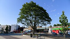
Herne Hill
| Herne Hill | |
|---|---|
 Herne Hill Junction |
|
| Herne Hill shown within Greater London | |
| OS grid reference | TQ325745 |
| London borough | |
| Ceremonial county | Greater London |
| Region | |
| Country | England |
| Sovereign state | United Kingdom |
| Post town | LONDON |
| Postcode district | SE24 |
| Dialling code | 020 |
| Police | Metropolitan |
| Fire | London |
| Ambulance | London |
| EU Parliament | London |
| UK Parliament | |
| London Assembly | |
Herne Hill /hɜːrn/ is a district in south London, England, approximately four miles from Charing Cross and bordered by Brixton, Denmark Hill, Dulwich Village, Loughborough Junction and Tulse Hill. It overlaps the boundary between the boroughs of Lambeth and Southwark. There is a road of the same name in the area (which is part of the A215 and was formerly called Herne Hill Road).
In Rocque's 1746 map, the area is shown as "Island Green", probably reflecting the presence of the River Effra and smaller tributaries. Early references to the area also use the form "Ireland Green".
The earliest documented reference to "Herne Hill" is in two fire insurance policies issued by the Sun Insurance Company in 1792 (where the spelling is "Hearns" and "Herns" Hill).
The area now known as Herne Hill was part of the Manor of Milkwell, which existed from at least 1291, and was a mixture of farms and woodland until the late 18th century. It was divided between the ancient parishes of Camberwell and Lambeth. In 1783, Samuel Sanders (a timber merchant) bought the land now occupied by Denmark Hill and Herne Hill from the Manor; he then began granting leases for large plots of land to wealthy families.
By the mid-19th century, the road from the modern Herne Hill Junction to Denmark Hill was lined with large residential estates and the area had become an upper-class suburb (John Ruskin spent his childhood at an estate on Herne Hill).
...
Wikipedia

