Hennessey, Oklahoma
| Hennessey, Oklahoma | |
|---|---|
| Town | |
| Motto: "A Light on the Prairie" | |
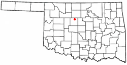
 Location of Hennessey, Oklahoma |
|
| Coordinates: 36°6′29″N 97°53′54″W / 36.10806°N 97.89833°WCoordinates: 36°6′29″N 97°53′54″W / 36.10806°N 97.89833°W | |
| Country | United States |
| State | Oklahoma |
| County | Kingfisher |
| Area | |
| • Total | 3.7 sq mi (9.7 km2) |
| • Land | 3.7 sq mi (9.6 km2) |
| • Water | 0.0 sq mi (0.0 km2) |
| Elevation | 1,161 ft (354 m) |
| Population (2000) | |
| • Total | 2,058 |
| • Density | 552.7/sq mi (213.4/km2) |
| Time zone | Central (CST) (UTC-6) |
| • Summer (DST) | CDT (UTC-5) |
| ZIP code | 73742 |
| Area code(s) | 405 |
| FIPS code | 40-33700 |
| GNIS feature ID | 1093669 |
Hennessey is a town in Kingfisher County, Oklahoma, United States. The population was 2,131 at the 2010 census, up from 2,058 in 2000.
Hennessey is named after Pat Hennessey, an Irish freighter who was killed at the present townsite in April, 1874. He was said to have been burned on a wagon wheel, either by native Cheyenne tribesmen or white horse thieves.
The Pat Hennessey Memorial Park can be found at the streets of Iowa and Arapaho. The location of his body is another story. Pat Hennessey was originally buried next to the location of his death in a shallow grave. Rocks were placed over his body, and teamsters passing by would continue to place markers on his grave. At some point in history Pat’s body was moved. It is possible Pat’s relatives came from Ireland and reclaimed his body. In any case, it is not at the marker site at Memorial Park: excavations there produced no remains.
The town was laid out by the Hennessey Townsite Company after the land run of April 22, 1889. The Chicago, Kansas and Nebraska Railway, which was owned by the Chicago, Rock Island and Pacific Railway, built a line from Kansas through the Cherokee Outlet, and the first train arrived in September 1889. The town was incorporated on June 10, 1890.
Hennessey is located at 36°6′29″N 97°53′54″W / 36.10806°N 97.89833°W (36.108022, -97.898321). It lies on the Chisholm Trail, the historic cattle trail on which is based today's U.S. Route 81. According to the United States Census Bureau, the town has a total area of 3.7 square miles (9.6 km2), of which, 3.7 square miles (9.6 km2) of it is land and 0.04 square miles (0.10 km2) of it (0.53%) is water.
...
Wikipedia
