Heene
| Heene | |
|---|---|
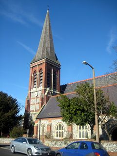
 St Botolph's Church |
|
| Heene shown within West Sussex | |
| Population | 7,859 (2011.Ward) |
| OS grid reference | TQ138027 |
| District | |
| Shire county | |
| Region | |
| Country | England |
| Sovereign state | United Kingdom |
| Post town | Worthing |
| Postcode district | BN11 0 |
| Police | Sussex |
| Fire | West Sussex |
| Ambulance | South East Coast |
| EU Parliament | South East England |
| UK Parliament | |
Heene is a neighbourhood of the Borough of Worthing in West Sussex, England. It lies on the A259 road 0.6 miles (1 km) west of the town centre.
Heene comes from the word hīun or hīwun meaning family or household.
Once part of the parish of West Tarring, Heene was a civil parish in its own right from the 16th century until 1890 when it became part of the Borough of Worthing. Its borders are defined by the Teville Stream and Tarring Road to the north and Elm Grove and Wallace Avenue (once known as Sea Lane) to the west.
During the English Civil War in January 1644, the Spanish warship the Santiago (St James), was beached at Heene. The ship had several Royalist officers on board, as well as 24 brass guns, 2,000 arms and 100 barrels of gunpowder and a large cargo of linen. The ship had set sail from the port of Dunkirk, at the time part of the Spanish Empire, having been pursued by Dutch men of war and to avoid capture seems to have tried to head for either Shoreham or Arundel. The ship was seized by the Parliamentarian William Waller and its contents taken to be securely stored at Arundel Castle.
In the 1670s, three streets in Heene are mentioned - East Street, West Street and High Street (today's Heene Road).
As with other parts of Worthing, the coastline of Heene has changed greatly in recent centuries. The sea is thought to have encroached some 55 yards (50 m) in the century up to 1875. In the early 19th century, the area along the coast known as Heene Common was made up of rough pasture intersected by watercourses and covered with gorse.
In the early 19th century settlement was in Heene village and in an area known as Little Heene in Brunswick Road. The area had a reputation for wildness and lawlessness at the time. Edward Ogle (known locally as 'King' Ogle) and other Commissioners in the new town of Worthing to the east erected a wall at the Heene-Worthing boundary to keep the 'lawless' of Heene out of the civilised east.
...
Wikipedia

