Hattiesburg-Laurel Regional Airport
| Hattiesburg–Laurel Regional Airport | |||||||||||
|---|---|---|---|---|---|---|---|---|---|---|---|
 |
|||||||||||

USGS 1996 orthophoto
|
|||||||||||
| Summary | |||||||||||
| Airport type | Public | ||||||||||
| Owner | Regional Airport Authority | ||||||||||
| Serves | Hattiesburg / Laurel, Mississippi | ||||||||||
| Location | Jones County, Mississippi | ||||||||||
| Elevation AMSL | 298 ft / 91 m | ||||||||||
| Coordinates | 31°28′02″N 089°20′13″W / 31.46722°N 89.33694°WCoordinates: 31°28′02″N 089°20′13″W / 31.46722°N 89.33694°W | ||||||||||
| Website | www |
||||||||||
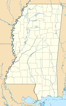
| Map | |||||||||||
| Location of airport in Mississippi / United States | |||||||||||
| Runways | |||||||||||
|
|||||||||||
| Statistics (2012) | |||||||||||
|
|||||||||||
|
Source: Federal Aviation Administration
|
|||||||||||
| Aircraft operations | 37,710 |
|---|---|
| Based aircraft | 62 |
Hattiesburg–Laurel Regional Airport (IATA: PIB, ICAO: KPIB, FAA LID: PIB), nicknamed Airport City, is a public airport located in Jones County, Mississippi. The airport is located in an unincorporated area near Moselle, nine nautical miles (10 mi, 17 km) north of Hattiesburg and 23 miles southwest of Laurel. It is mostly used for general aviation, but is also served by one commercial airline. Service is subsidized by the Essential Air Service program.
The airport's IATA code (PIB) refers to its former name, Pine Belt Regional Airport.
Hattiesburg is halfway between Mississippi's two major airports – Gulfport–Biloxi International Airport and Jackson–Evers International Airport. The three cities are linked by the four-lane U.S. Highway 49.
As per the Federal Aviation Administration, this airport had 12,576 passenger boardings (enplanements) in calendar year 2008, 12,972 in 2009, and 13,766 in 2010. The National Plan of Integrated Airport Systems for 2011–2015 categorized it as a primary commercial service airport.
...
Wikipedia


